|
||

|

|
|

|
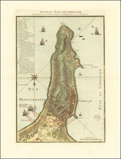
Uncommon original antique map of the Gibraltar Peninsula, showing the peninsula under siege. The map shows the progress of the 1727 Spanish attack on the British-held peninsula and was published in Paris by the French engraver Guillaume Nicolas Delahaye in that year.
This highly decorated and detailed map shows Gibraltar in great detail, focusing on the lines of fire that English ships have on Spanish redoubts and the lines of fire that Spanish fortifications have on the British-held city. An extensive legend describes a number of places of interest through the map, and many annotations are made in the city, on the Rock, and at sea. Sailing ships and more appear at sea, with British fleets shown firing their canons.
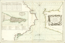
The 1727 Siege of Gibraltar
Known as the Thirteenth Siege of Gibraltar, this siege was conducted by Spanish troops against the British city. The Spanish army and navy were particularly weak at this time, but Philip V decided to pursue the siege regardless as he viewed that the English had encroached too much on their promises made in the earlier Treaty of Utrecht. The siege was conducted from the Spanish-held mainland, which overlooked the town of Gibraltar. However, the superior British navy prevented any sort of blockade and quickly reinforced the garrison. Spanish troops withdrew after five months.
This map shows the siege in its earliest era, only two weeks in. The map cites the data shown as accurate to the 22nd and 23rd of February, and the siege had only started on the 11th.
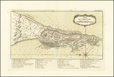
![(Siege of Gibraltar) Plan Géometral de la Ville et de la Montagne de Gibraltar Nouvellement Corrigé d'apres les Originaux Anglais [Geometrical Map of the Town and Mountain of Gibraltar, Newly Corrected from the English Originals]](https://storage.googleapis.com/raremaps/img/small/94412.jpg)
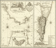
![[ Gibraltar ] Plan du promontoire de la ville et du port de Gibraltar avec les ouvrages faits depuis le dernier siège et les lignes construites par ordre de sa Majesté très catholique, pour empescher la communication de Gibraltar avec l'Espagne : levé nouvellement sur les lieux par l'ingenieur de la place.](https://storage.googleapis.com/raremaps/img/small/98510.jpg)