|
||

|

|
|

|
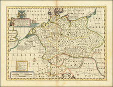
Mammoth wall map of Germany during the Second World War, issued as a school map in the aftermath of the war to teach German school children about Nazi crimes against humanity including the Holocaust.
Werner Hilgemann was the maker of the map and it was published by the firm Justus Perthes, which started in the 19th-century and was active through the Nazi era, finally going defunct in 2008.
The maker, Werner Hilgemann, was a German author, educator, and cartographer who produced wall maps for schools from the 1960s. He died in 2004 in Bielefeld.
The map includes a complicated and detailed accounting of dozens of events and datasets related to the crimes of the Nazis. These are elaborated in the key in the lower-right corner, which includes almost 50 symbols.
A primary focus of the map is the Holocaust, which is represented with large Stars of David (the interior number on the top represents the minimum estimate - in thousands - of Jews killed in that country, the number at the bottom is the maximum estimate), smaller Stars of David represent synagogues destroyed during Kristallnacht, there are also symbols for Ghettos and death camps.
There are also symbols for foreign laborers in Germany in 1945, various SS installations, etc.
The map is an important document for how the Second World War was taught in West Germany about 20 years after the war had concluded.