


|
||

|

|
|

|
Stock# 80621
Description
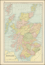
Valk and Schenk's map of eastern Scotland, showing Aberdeen and Inverness. The map is highly detailed and very decorative, and represents one of the most attractive 17th-century maps of the region.
The map lists hundreds of small towns and shows mountains, rivers, glens, firths, lochs, and many other features. "Old" and "New" Aberdeen are shown. Two ships can be found at sea, as well as a sea monster. The map shows Loch Ness, Inverness, and the north Cairngorms.
This map represents a later state of a map of the same name first published by Jan Jansson sometime around 1646. Jansson published a series of maps of the British regions, which were based on the most accurate sources at the time.
![[Southern Scotland] Des Konigreichs Scotland sudlicher Theil Nro. 87](https://storage.googleapis.com/raremaps/img/small/83654.jpg)
![[ United Kingdom ] Tabula Prima Europae](https://storage.googleapis.com/raremaps/img/small/78537.jpg)
![A New Map of the North Part of Scotland [North sheet only]](https://storage.googleapis.com/raremaps/img/small/89745.jpg)