The item illustrated and described below is sold, but we
have another example in stock. To view the example which
is currently being offered for sale, click the
"View Details" button below.


|
||

|

|
|

|
Stock# 80597
Description
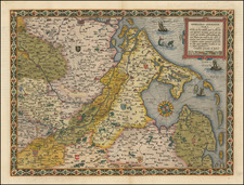
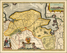
A fine early map of the the Groningen region, which appeared in Petrus Kaerius's (Peter Van der Keere) Germaniae Inferior id est, XVII Provinciarum ejus novae et exactae Tabulae Geographicae, first published in Amsterdam in 1617.
Van der Keere's atlas was the first separately published atlas of the Low Countries.
The map includes a view of Groningen, a coat of arms and costumes showing typical regional dress.
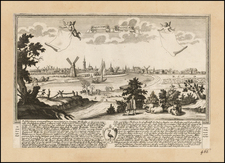
![[Course of the Rhine River] Nova Tractus Totius Rheni Oder Neue beschreibung des Rhein-Strom](https://storage.googleapis.com/raremaps/img/small/58670.jpg)