|
||

|

|
|

|
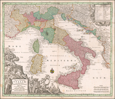
Rare Map Showcasing the Complexities of the Italian Political System
Innovative and rare map of the 1913 Italian general election utilizing a data visualization technique that allows the average viewer to quickly understand the results of the election. This intriguing piece is colored mostly blue, representing the landslide victory won by the right-of-center liberal and democratic alliance. The map's "equal area" projection, in which all districts are the same size, foreshadows by one hundred years the maps that have become popular in US presidential and congressional to show the true balance of electoral results. The map is both important for this technique, as well as preserving a trove of electoral information not readily accessible through other means.
This map was designed by F. D. Guerzoni and published by the Nerbini publishing house in Florence. It was intended for a general audience, being priced at 20 centesimi, and its bright colors and important subject would have made it an easy sell in newsstands.
In order to explain the map, the premise of the Italian political system must first be understood. In 1913, the Parliament of the Kingdom of Italy was composed of two houses: an appointed senate and an elected (with non-universal male suffrage) Chamber of Deputies. Each deputy was appointed by a single Electoral College, which varied in number over the years, but, at the time of this map, numbered 508. Elected deputies came from a number of parties, but they could be grouped into five main alliances, of which the "monarchical" or "liberal and democratic" coalition was the strongest.
The map shows each of these electoral colleges as a square on the map, with all squares being of the same size. Thus, Naples's 12 electoral districts represent a significant area on the map, and socialist votes concentrated in cities or other regions are not hidden from view. As such, by representing the results of the election in this way, the reader can immediately tell the relative power of each grouping, regardless of the relative spatial area of their constituencies.
Each electoral college is shown on the map, with a note naming the constituency, the deputy elected, and a symbol naming the party. The square is then colored according to the alliance to which the party subscribes. Electoral Colleges are grouped together into districts using a bold line, the meaning of which is not fully clear.
The XXIV Chamber of Deputies
The 1913 Italian General Election was heavily affected by electoral changes enacted in 1912 that eliminated the tax requirement for voting and enfranchised all literate men over 21 and all men over 30. In order to maintain traditional power, the liberal left and monarchist right underwent a "Trasformismo" into a single Liberal Union. Other alliances going into the election were the Radical, Republican, Socialist, and Clerical (Catholic) alliances.
The results of the election had the Liberal Union gaining an absolute majority, winning 270 deputies out of 508. With their partners, they achieved a total of 309 deputies, as shown on the map. This allowed the liberals to continue holding on to power until the end of World War II.
Rarity
We find no examples of the map listed in OCLC or in other institutional searches.