|
||

|

|
|

|
Rare Late State with the Insets of the Gadsden Purchase and Nebraska-Kansas-Missouri-Iowa Corridor.
Rare late state of this already rare and important separately issued map of Kansas and Nebraska, published by J.H. Colton in New York. This is the fourth edition one of the most sought-after maps of the Transmississippi West, notable for its primacy in showing the states of Nebraska and Kansas, as well as for its size and accuracy in the Rocky Mountain region.
Colton's map is the first printed map to show the configurations of Nebraska and Kansas after the creation of Kansas Territory. The map encompasses the territories of Nebraska and Kansas as well as the surrounding areas. It extends westward to the Great Salt Lake and to Crockett, Texas in the south.
The first inset at the bottom of the map shows the recently acquired Gadsden Purchase, completed in 1854. This Gadsden Purchase allowed for the southwards extension of Arizona and New Mexico. This extended the territory further past the more mountainous regions of these states, which Southerners believed would allow for the completion of a southern transcontinental line. This was delayed due to conflicts regarding slavery.
The inset in the lower left shows the Mississippi River between Sioux City and southern Missouri. This inset is based on Colton's maps of the region issued in his New General Atlas.
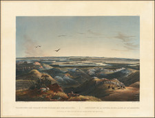
The map shows a number of interesting vignettes showing settlers, the wildlife, and Native Americans are pictured. Many curious notes abound, including one that reads that "All the Indian Tribes under the protection of the United States recognize a Head or principal Chief through whom all transactions with the government are conducted." This and other notes suggests that one of the maps many intended uses would have been for westward migrating settlers.
State and Rarity
As noted by Rumsey (describing this edition of the map):
Fourth edition, with the inset at the lower left of the United States replaced by a taller, large-scale inset map of the eastern counties of Nebraska and Kansas. The main map is mostly unchanged, with only a few railroad routes added. The addition of the detailed county map inset was probably due to the "bleeding Kansas" troubles of 1856. Map is full color by state, folded into brown cloth covers 15x9 with "Nebraska And Kansas" stamped in gilt, advertisement for Colton on inside front cover. Relief shown by hachures.
Unlike earlier states, there are some unusual features to the route of the Northern Pacific. For example, at the eastern terminus on the map, near St. Paul, an additional route is added heading due eastwards.
This is the first time have ever had this late edition.
G. W. & C. B. Colton was a prominent family firm of mapmakers who were leaders in the American map trade in the nineteenth century. Its founder, Joseph Hutchins Colton (1800-1893), was a Massachusetts native. Colton did not start in the map trade; rather, he worked in a general store from 1816 to 1829 and then as a night clerk at the United States Post Office in Hartford, Connecticut. By 1830, he was in New York City, where he set up his publishing business a year later.
The first printed item with his imprint is dated 1833, a reprint of S. Stiles & Company’s edition of David Burr’s map of the state of New York. He also printed John Disturnell’s map of New York City in 1833. Colton’s next cartographic venture was in 1835, when he acquired the rights to John Farmer’s seminal maps of Michigan and Wisconsin. Another early and important Colton work is his Topographical Map of the City and County of New York and the Adjacent Country (1836). In 1839, Colton began issuing the Western Tourist and Emigrant’s Guide, which was originally issued by J. Calvin Smith.
During this first decade, Colton did not have a resident map engraver; he relied upon copyrights purchased from other map makers, most often S. Stiles & Company, and later Stiles, Sherman & Smith. Smith was a charter member of the American Geographical and Statistical Society, as was John Disturnell. This connection would bear fruit for Colton during the early period in his career, helping him to acquire the rights to several important maps. By 1850, the Colton firm was one of the primary publishers of guidebooks and immigrant and railroad maps, known for the high-quality steel plate engravings with decorative borders and hand watercolors.
In 1846, Colton published Colton’s Map of the United States of America, British Possessions . . . his first venture into the wall map business. This work would be issued until 1884 and was the first of several successful wall maps issued by the firm, including collaborative works with D.G. Johnson. From the 1840s to 1855, the firm focused on the production of railroad maps. Later, it published a number of Civil War maps.
In 1855, Colton finally issued his first atlas, Colton’s Atlas of the World, issued in two volumes in 1855 and 1856. In 1857 the work was reduced to a single volume under the title of Colton’s General Atlas, which was published in largely the same format until 1888. It is in this work that George Woolworth (G. W.) Colton’s name appears for the first time.
Born in 1827 and lacking formal training as a mapmaker, G. W. joined his father’s business and would later help it to thrive. His brother Charles B. (C. B.) Colton would also join the firm. Beginning in 1859, the General Atlas gives credit to Johnson & Browning, a credit which disappears after 1860, when Johnson & Browning launched their own atlas venture, Johnson’s New Illustrated (Steel Plate) Family Atlas, which bears Colton’s name as the publisher in the 1860 and 1861 editions.
J.H. Colton also published a number of smaller atlases and school geographies, including his Atlas of America (1854-56), his Illustrated Cabinet Atlas (1859), Colton’s Condensed Cabinet Atlas of Descriptive Geography (1864) and Colton’s Quarto Atlas of the World (1865). From 1850 to the early 1890s, the firm also published several school atlases and pocket maps. The firm continued until the late 1890s, when it merged with a competitor and then ceased to trade under the name Colton.
![[ The Old Northwest Territory ] Il Paese De Selvaggi Outagamiani, Mascoutensi Illinesi E parte Delle VI Naxioni](https://storage.googleapis.com/raremaps/img/small/75927.jpg)


![[Rare First State] Novissima Tabula Regionis Ludovicianae Gallice dictae la Louisiane . . .](https://storage.googleapis.com/raremaps/img/small/72622.jpg)