|
||

|

|
|

|
Rare Map of the First Major Canadian Battle of the French and Indian War. The Battle that Lead to the Expulsion of the Acadians.
Rare and important antique etched map showing the site of the Battle of Fort Beausejour, the opening of the British offensive in the Acadian and Nova Scotian Theatre of the worldwide Seven Years' War. This map was published in Paris shortly after the British victory at Beauséjour. This work was engraved by Georges-Louis Le Rouge, an engraver who was notable for his collaboration with English and American sources, particularly Benjamin Franklin.
The map shows the strip of land between the Bay of Fundy and the Baie Verte at the border between present-day Nova Scotia and New Brunswick, which is of immense strategic importance. Detail on the map is exemplary of early colonial surveys, with topography, rivers, place names, and cultivated areas shown. Fort Cumberland (also known as Fort du Beausejour), Fort St. Laurent, and Fort Caspereau are all named, with the roads that connect them shown. The extreme tides of the Bay of Fundy are hinted at, with a huge sandbank that is uncovered at low tide shown, while depth soundings are also provided.
The Isthmus of Chignecto, on which Fort Beausejour sat, had been the subject of contention since the 17th century. This Isthmus, which connects Nova Scotia to the rest of mainland Canada, is located at the end of the Bay of Fundy. Since Nova Scotia was a British colony and the region to the west was historically French, this narrow strip of land was extensively fought over. The English led raids on French settlements in the area during King William's War and Queen Anne's War, and at least three skirmishes happened there between 1749 and 1751 during Father Le Loutre's War.
This map evidently postdates the battle, as well as the manuscript map held by the Library of Congress called A Plan of Chignecto. This latter map refers to the fort as being French, while the presented map gives the fort the name "Cumberland" in addition to "Beausejour," which it was only referred to after the war. This map was instead drawn on a survey conducted by a British officer in June shortly after the battle, which was published in England by Jefferys and likely reached Le Rouge this way.
The Battle of Fort Beauséjour
The Battle of Fort Beauséjour was waged in June of 1755 at the site of the recently constructed Fort. Following the erection of Fort Lawrence in 1750, French forces under Father Le Loutre decided to build a separate fort across the border, which was completed in 1755. Chignekto was considered of high importance due to its location connecting Acadians and the outer French isles to Quebec and Montreal.
Following the start of the Seven Years' War, early British failures led to the decision to push for a campaign in the Acadian theatre. Due to the location of the fort, it was realized from early on that this would be one of the primary British targets, so a large garrison had been stationed there. However, the bombardment of the fort, coupled with the betrayal of the French captain's secretary, led to the rapid success of the British siege.
The loss of the French of the Battle of Beausejour, which many Acadians had participated in, is cited as the major reason that lead to their genocide. Following the humiliating defeat of several British forces that year, the forced deportation of the Acadians in occupied territories was undertaken to deprive the French of fighting forces and to promote a perceived victory.
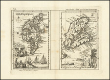
![[Newfoundland] Carta Esferica en dos hojas Del Banco y La Isla De Terranova con parte de la Costa de Labrador, Consruida en la Direccion de Hidrografia seun las ultimas publicadas por el Deposito hidrografico de Londres y presantada a S.S.M.M. por Don Juan de Dios Sotelo . . . 1840](https://storage.googleapis.com/raremaps/img/small/42237sh.jpg)

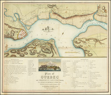
![[ Siege of Quebec ] Quebek, De Hoofdstad van Kanada; aan de Rivier van St. Laurens . . . 1759](https://storage.googleapis.com/raremaps/img/small/93087.jpg)