The item illustrated and described below is sold, but we
have another example in stock. To view the example which
is currently being offered for sale, click the
"View Details" button below.


|
||

|

|
|

|
Stock# 79699
Description
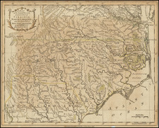
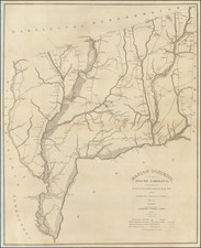
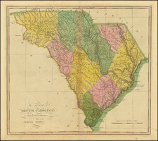
Finely colored example of Carey's map of South Carolina, hand-colored by counties, from the 1814 edition of Mathew Carey's General Atlas.
The map provided a large format and highly detailed map of the state, showing towns, roads, rivers, mountains, swamps, counties, meeting houses, and substantial other detail.
One of the earliest obtainable maps of the state of South Carolina.