|
||

|

|
|

|
Stock# 79679
Description
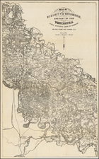
Detailed Revolutionary War map of Virginia and part of Maryland, providing details from the American Revolution, which Verner notes has having been drawn from the Fry & Jefferson map of Virginia & Maryland.
The map extends from the mouth of the Pautuxet River to just south of Cape Henry and extending East to the Old Court House near Albermarle, Buckingham, Cumberland and Prince Edward Counties. Includes most of the Lower Chesapeake.
The map was bound into Volume IV of William Gordon's THE HISTORY OF THE RISE, PROGRESS, AND ESTABLISHMENT OF THE INDEPENDENCE OF THE UNITED STATES OF AMERICA… published in London in 1788. Includes numerous roads, counties, towns, rivers, court houses, islands, and other contemporary Revolutionary War information.