


|
||

|

|
|

|
Stock# 78866
Description
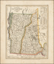
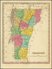
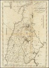
Detailed map of Vermont & New Hampshire. Shows counties, townships, towns, rivers, lakes, etc.
Morse & Breese's North American Atlas was a landmark in American Cartography, being the first atlas to employ the cerographic printing process, which would revolutionize the map trade. The Morse family and this process are the subject of David Woodward's The All American Map. The maps were first printed in a series of inserts which appeared in the New York Post and later as a separate atlas.
Condition Description
Mended tear from the right edge into the image. Cleaned with the printed ink somewhat smeared.
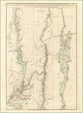
![[Lake Champlain and environs] Carte de la Riviere de Richelieu et du Lac Champlain](https://storage.googleapis.com/raremaps/img/small/91308.jpg)
