This item has been sold, but you can enter your email address to be notified if another example becomes available.


|
||

|

|
|

|
Stock# 7819
Description
A nice map of China, with insets of Hong Kong, Amoy Island, Chusan and Hainan. The coastal detail is based upon the British Admiralty charts of the 1840s and the work of the Jesuits. A note indicates the 5 ports recently opened to outside trade by the Treaty of 1842. Adam & Charles Black were among the leading publishers of atlases and travel books in the 19th Century England.
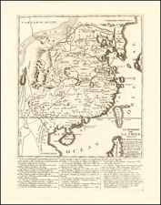
![Province de Chen-Si [Shaanxi Province]](https://storage.googleapis.com/raremaps/img/small/95545.jpg)
![[Nepal] Latest Trekking Map North North of Jomsom Jomsom to Mustang](https://storage.googleapis.com/raremaps/img/small/44106.jpg)