


|
||

|

|
|

|
Rare and Detailed Map of the Himalayas, from the Important Indian Atlas
Rare map of the Himalayas, focusing on the stunningly beautiful Wular Lake Basin in Kashmir.
The map was part of The Indian Atlas (1:253440 sheet 28), a project begun by James Horsburgh in the 1820s and continued by J & C Walker and the Survey of India until the 1910s. The Indian Atlas, with its distinctive and authoritative maps, was the standard quarter-inch series for India and Burma (now Myanmar) for nearly a century.
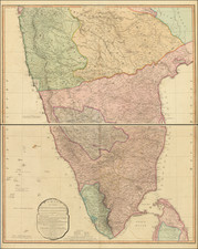
Showing a ruggedly beautiful mountainous area in great detail, the map includes a plethora of toponymic detail, naming passes, rivers, valleys, towns, and cities. The map extends to what is today the Lulusar-Dudipatsar National Park in the northwest, although the density of detail decreases in these remote areas. What is now Deosai National Park is labeled the "Plains of Deos" in the northeast.
The Indian Atlas began as the Atlas of India in 1824, when the East India Company ordered an atlas compiled of the work of the military surveyors who had make observations across India. Supervision of the engraving and publication fell to James Horsburgh, Hydrographer to the East India Company. It was continued by the J. & C. Walker firm after Horsburgh’s death in 1836, eventually passing to the Survey of India.
This is sheet 28 of the atlas and it covers one of the northernmost areas included in the atlas, as seen on this index map. It was one of the last to be published as full-size Double Elephant sheets in London. The project was then shifted to the auspices of the Survey of India, when the sheets were revised and issued, for the most part, as quarter sheets. The maps were considered the preeminent guides to the region for decades. Indeed, when, in 1904-5, the Indian Survey Committee needed quarter-inch maps on a new sheet grid, the old Indian Atlas sheets were cut up and reprinted photographically to produce the new “Provisional Issues.”
In the upper left corner of this example is a handwritten inscription with the name E. B. Carroll and “Byculla Club Bombay 1874.” The Byculla Club was the first residential club in Bombay (now Mumbai). Opened in 1833, it catered to the rich British residents of the city. Another owner’s mark is in the lower left corner, dated to 1894.
E. B. Carroll was the Locomotive Superintendent for the Bombay, Baroda and Central India Railway Company, which built the rail line between Mumbai and Ahmedabad between 1852 and 1870. As Locomotive Superintendent, Carroll held one of the most senior positions in the company and was in charge of the engines, carriages, and wagons of the railroad. He rose to the post in January 1865 after the death of his predecessor, G. N. Anderson. While in his post, he introduced premiums to reward drivers and firemen for conserving their coal supplies and was often a negotiator over wages and conditions with the employees of the company. He retired in 1897, after which a street was named for him in Mumbai.
T. G. Montgomerie
As indicated by the printed inscription in the lower left, this map was surveyed by Captain T. G. Montgomerie and D. G. Robinson as part of the Great Trigonometrical Survey of India. Little is known about Captain Robinson, but Thomas George Montgomerie (1830-1878) is today most famous for naming K1 and K2 in the Karakoram. Top of his class at Addiscombe College, training ground for the East India Company’s army, Montgomerie was posted to the Great Trigonometrical Survey a year after arriving in India in 1851.
Promoted first lieutenant in 1854, Montgomerie was then given command of the trigo-topographical survey of the lands of the maharajas of Janin and Kashmir, including the area seen on this map. His team worked through the mutiny of 1857 and Montgomerie was promoted captain in 1858. His work was highly commended, but his health was also severely compromised by the time his portion of the survey was completed. He returned to Britain and was awarded the founder’s medal by the Royal Geographical Society (RGS) in 1865. Not one to be kept down, Montgomerie returned to India in 1867, where he was given command of the Himalayan survey of Garhwal and Kumaon.
Before he left, however, Montgomerie had devised a solution to a sticky problem. The British wanted to survey into Tibet and its neighboring regions but European surveyors could not go beyond the borders of the Indian frontier. However, Montgomerie appreciated that Indian surveyors could travel without suspicion or political implications. He trained a cadre of pandits, as they were called. The first to go on mission was Abdul Hameed (Mohamed-i-Hameed), who surveyed the route to Yarkand in 1863. Unfortunately, Hameed died in the Karakoram Pass on his way back. His notes survived him, however, and Montgomerie decided to continue with the program. While they received little reward or recognition, many Indian surveyors contributed greatly to the geographic knowledge of Central, South, and Southeast Asia. The best known of these is Nain Singh, who surveyed Lhasa secretly in 1865-6, completely disproving D’Anville’s map of the area. Singh was later awarded the RGS’s patron’s medal. The pandits also earned an enduring place in popular culture; Montgomerie and his superior, Colonel James Walker, both published about the pandits in the Journal and Proceedings of the RGS, and the intrepid Indian surveyors were the basis of Rudyard Kipling’s Kim, with Montgomerie as the model for Colonel Creighton.
Montgomerie continued to oversee the training and deployment of the pandits. He was appointed acting superintendent of the Indian Survey in 1870-3. Promoted to major and elected a Fellow of the Royal Society in 1872, he was nevertheless forced to return to England by ill health at the end of his time as acting superintendent. He retired as a colonel in 1876. He died in Bath in 1878.
The Great Trigonometrical Survey of India
The basis for the maps in the Indian Atlas was the works of military surveyors working for the Great Trigonometrical Survey of India, or GTS. The GTS was a project which aimed to measure the entire Indian subcontinent with scientific precision. It was begun in 1802 by the infantry officer William Lambton under the auspices of the East India Company. In an attempt to equip his team with the latest technology, Lambton ordered a specialized theodolite for the work. However, the ship carrying the instrument was captured en route by the French; luckily, the French allowed the instrument to continue its journey to India.
Under the leadership of Lambton’s successor, George Everest, the project was made a responsibility of the Survey of India. Everest was succeeded by Andrew Scott Waugh. After 1861, the project was led by James Thomas Walker, who oversaw the initial completion of the works in 1871.
Due to the extent of the land to be surveyed, the surveyors did not triangulate the whole of India but instead created what they called a "gridiron" of triangulation chains running from north to south and east to west.
Among the many accomplishments of the Survey of India were the demarcation of the British territories in India and the measurement of the height of the Himalayan giants: Everest, K2, and Kanchenjunga. The Survey of India had an enormous scientific impact as well: it was responsible for one of the first accurate measurements of a section of an arc of longitude, and for measurements of the geodesic anomaly which led to the development of the theories of isostasy. It is not an exaggeration to say that, in the nineteenth century, the Survey’s mapping techniques and cartographic outputs were the most advanced in the world.
J. & C. Walker was the imprint used by the Walker family of engravers and printers. They produced numerous high-quality geographical maps and nautical charts for a variety of institutions in the nineteenth century. John Walker (1787-1873) held the position of Hydrographer to the East India Company, a position also held by his father and namesake. John worked in partnership with his brothers, Charles and Alexander. The brothers published over 200 maps for the Society for the Diffusion of Useful Knowledge. They produced maps for James Horsburgh and the Admiralty, as well as the influential Indian Atlas.
![[District Bholawade]](https://storage.googleapis.com/raremaps/img/small/66013.jpg)
![[ Bombay ] Plan du Port de Bombay situe par 19 deg. de Lattit. Nord et par 70 deg. 41 min de Longit du Meridien de Paris](https://storage.googleapis.com/raremaps/img/small/95158.jpg)