|
||

|

|
|

|
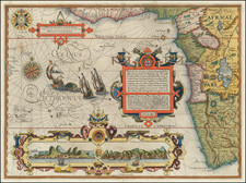
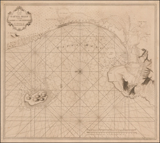
Detailed sea chart of the area around the bay of Saldanha, in the Western Cape. This map originally appeared in Luffman's Select Plans . . .
The chart indicates maritime and coastal features, including reefs, sandbars, and high points. A note at the bottom refers to the capture of a Dutch Squadron in the bay in 1796. This bay also served as the location for the capture of six Dutch East Indiamen by an 1783 expedition sent to capture Cape Town; this was that expedition's only success.
Luffman's Select Plans is an uncommon traveler's guide that served to educate the intrepid traveler regarding any part of the world, from the major cities of Europe to the wild coasts of the Spice Islands. Each of Luffman's maps contained detailed coastal descriptions showing the major landmarks and cities, as well as basic but necessary navigational information. This plate appeared in the second of Luffman's two volumes.