|
||

|

|
|

|
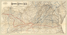
The First Mineralogical Mapping of the Coal and Iron Capital of America.
Fascinating mineralogical and geological map of the region that would one day become West Virginia, focused on showing relevant geological and mineral deposits. This map was published by Samuel Prescott Hildreth, one of the fathers of Ohio geology.
The map is focused on the region surrounding the Ohio River Valley, encompassing parts of the states of Western Virginia, Ohio, and Pennsylvania. Columbus and Pittsburg appear, and small parts of Kentucky, Tennessee, and North Carolina can be seen.
A key to the right of the map shows the locations for many geological features, including various types of springs, caves, petroleum springs, iron ore, limestone, red marl, lead, lime sulfate, and white lias. To the left of the map is a cross-section of the elevation of the Ohio Valley near Marrietta, Hildreth's residence.
This map is designed in the style of early mineralogical maps, which predate the color-coded maps that show strata. This style of mapping instead focuses on the extent and types of various deposits, without mention of age. The mention of White Lias deposits on this map (a term usually referring to a white limestone of a certain age) near Summersville does not appear on modern geological maps but may have been an attempt to classify strata. Prescott would have been aware of the recent advancements in the field of geology and may have included this to make it more akin to the maps that were being published of Great Britain and the eastern states.
Primacy
This is the earliest map listed in the USGS's 1884 A Catalogue of Geological Maps of America 1752-1881 for the region of Ohio, and their catalog for the Southern States (including Virginia) does not list anything relevant to the area published earlier. This would make it the first mineralogical (if not geological) map of West Virginia and Ohio, two states whose long history rests on their coal and iron deposits.
Samuel Prescott Hildreth was an eastern-educated scientist and physician whose father had been an early investor in the Ohio Company of Associates. Hildreth first visited Ohio in 1806 and spent his life documenting the nature and history of the state. He was particularly notable for his drawings of local botany and animals, and he also published an important work on the early pioneers of Ohio. He was also involved in the field of geology, which allowed him to create the present map.
![(Cleveland Beer Drinkers) [Photograph of Zwiebel Brigade Drinking Beer in Cleveland]](https://storage.googleapis.com/raremaps/img/small/96294.jpg)