This item has been sold, but you can enter your email address to be notified if another example becomes available.


|
||

|

|
|

|
Stock# 77577
Description
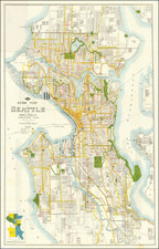
Attractive early map showing the neighborhood of Bellevue in eastern Seattle. The map shows major roads railroad lines and more. The Medina peninsula is shown with significant annotations, including the location of the old "Bay School" and an offshore sailboat.
Bridle Trail State Park appears at the top of the map, and the map extends as far eastwards as Lake Sammamish. The floating bridge across Lake Washington is shown.
This map was produced by Maury Johnson, an oil dealer located near the border between Medina and Bellevue. The verso of the map shows a map of roads from Bellevue eastwards to the foot of the Cascades.
Condition Description
Trimmed close to upper neatline. Minor staining.
![[ Rare Early State! ] America's Greatest Scenic Asset The Columbia River Highway [cover title:] Portland Oregon featuring the Columbia River Highway](https://storage.googleapis.com/raremaps/img/small/77120.jpg)
![[ Mt. St. Helens Hazard Analysis Archive - Including Volcanic Ash ] Mount St. Helens Diary: A Sunday Holocaust](https://storage.googleapis.com/raremaps/img/small/72403.jpg)