


|
||

|

|
|

|
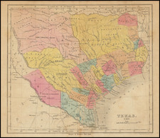
Mammoth Geological Map of Texas
A truly gigantic map of Texas in four sheets, which stretches to nine feet by six and a half feet when joined. Attractively colored, this map shows the geology of the state, including showing more than one hundred types of strata.
This map represents an advancement over the widely available 1933 map not just for the extra three years of data available (compiled until 1935 rather than 1932), but for the level of detail which this map affords. The size of the map allows for units only a few miles wide to be resolved in their own color, this allows for naturally thin units, such as quaternary sediments, to be resolved in full.
This map was published at a time when Texas was leading the nation in oil production, in the year that this map was published, it would extract over five billion barrels. This map allows for the geological history of the state which lead to this wealth to be easily read. The progression into generally older rocks as the map tracks into the northwest is notable, as well as the igneous and metamorphic complexes visible in the western part of the state. The Texas panhandle is presented in an inset.
This map states that it was:
Compiled between the years 1924 and 1935, in cooperation with the Bureau of Economic Geology of the University of Texas, the geologists of Texas, and the oil companies of Texas, from all available published material and from unpublished data furnished by geologists of the United States Geological Survey, the Bureau of Economic Geology of the State of Texas, and oil companies and by consulting geologists.
This public-private partnership would have been useful to the scientific community for allowing for the generation of knowledge, and allowed private companies to benefit from better oil knowledge.
This map was compiled by the three USGS scientists Nelson Darton, Lloyd Stephenson, and Julia Gardner. Julia Gardner was an internationally renowned biostratigrapher who worked extensively on mollusc paleontology in order to better refine the relative dating of strata. Having served as an auxiliary nurse in France during World War I, she then returned to the US to study Gulf Coast fauna. Following the publication of this map, she worked with the Military Geology Unit during World War II. She contributed heavily to the war effort, identifying beaches that were used to launch incendiary bombs by identifying the shells mixed in with sand ballast.
In all, a great map of the state of Texas, exceptional for its size and coloring.
Rarity
No references in Rare Book Hub. While institutional holdings of this map are not uncommon, we note only two examples of this map ever having been on the market.

![Texas [The Rand McNally Vest Pocket Map of Texas]](https://storage.googleapis.com/raremaps/img/small/86827.jpg)
![[ Southern Railroads ] Railroad Map of the Southern States Shewing the Southern & Southwestern Railway Connections With Philadelphia. 1862 . . . Prepared by Thomas Kimber Jr., Chairman of the Committee on Inland Transportation of the Board of Trade of Philadelphia](https://storage.googleapis.com/raremaps/img/small/103211.jpg)