|
||

|

|
|

|
Finely colored example of Braun & Hogenberg's views of Orleans and Bourges, from their Civititas Orbis Terrarum.
ORLÉANS
English Translation of verso:
Orléans is a city in France on the Loire. In the direction of Paris, where the city spreads out upon a hill, stood the Church of the Holy Cross before its recent destruction by the Huguenots. Orléans has clean, healthy air and is graced with excellent schools. Law is the subject most commonly studied. So many erudite men have gone forth from these schools that there is not enough space here to tell of them all. Among others the important Bertrandus, Archbishop of Bordeaux, who later became Pope in Rome and took on the name Clement V.
Seen from the south, the view shows Orléans on the far side of the Loire. In the centre, rising above the city, is Sainte-Croix cathedral, which was built around the end of the 13th century. The destruction referred to in the text can be dated to 24 March 1568; reconstruction was begun under Henry IV around 1600. Since the early 14th century Orléans had played a key role in armed conflicts, which came to a climax when the city was besieged by the English and subsequently liberated by Joan of Arc in 1429. The University d'Orléans was founded in 1235; 200 years after Pope Clement V, John Calvin also studied law here.
BOURGES
English Translation of verso:
Today one can still see the entire wall of the Old Town of Avaricum, which is so strongly fortified that no tools can pull it down, so that it must therefore be left standing. Bourges was expanded by degrees. At one place towards the southeast there is an opening, secured by strong walls and fortified ramparts. From them one can see a long way, but in particular there is a high tower here from which one can see four miles around and which is therefore called the Great Tower.
The view shows Bourges from the south on the far side of the River Auron. The name of the city is derived from the Celtic tribe of the Bituriges, whose chief town, Avaricum, was here. The well-fortified walls, the remains of which can still be seen today, date from this time. In 1137 Louis VII was crowned king of France in Bourges. Under him and his successor Philip II the city was expanded and a new fortification system was built. The fortress-like Great Tower (12) was destroyed in 1653 in the course of the revolt against absolutism known as the Fronde. Towards the end of the 12th century, construction began on the cathedral of Saint-Étienne (9), one of the earliest examples of High Gothic architecture, with stained-glass windows from the 13th century. The left side of the view is mainly dominated by the palace of Jacques Coeur (5). Coeur was an important merchant and Finance Minister under Charles II.
Georg Braun (1541-1622) was born and died in Cologne. His primary vocation was as Catholic cleric; he spent thirty-seven years as canon and dean at the church St. Maria ad Gradus, in Cologne. Braun was the chief editor of the Civitates orbis terrarum, the greatest book of town views ever published. His job entailed hiring artists, acquiring source material for the maps and views, and writing the text. In this role, he was assisted by Abraham Ortelius. Braun lived into his 80s, and he was the only member of the original team to witness the publication of the sixth volume in 1617.
Frans Hogenberg (ca. 1540-ca. 1590) was a Flemish and German engraver and mapmaker who also painted. He was born in Mechelen, south of Antwerp, the son of wood engraver and etcher Nicolas Hogenberg. Together with his father, brother (Remigius), uncle, and cousins, Frans was one member of a prominent artistic family in the Netherlands.
During the 1550s, Frans worked in Antwerp with the famous mapmaker Abraham Ortelius. There, he engraved the maps for Ortelius’ groundbreaking first atlas, published in Antwerp in 1570, along with Johannes van Deotecum and Ambrosius and Ferdinand Arsenius. It is suspected he engraved the title page as well. Later, Ortelius supported Hogenberg with information for a different project, the Civitates orbis terrarium (edited by Georg Braun, engraved by Hogenberg, published in six volumes, Cologne, 1572-1617). Hogenberg engraved the majority of the work’s 546 prospects and views.
It is possible that Frans spent some time in England while fleeing from religious persecution, but he was living and working in Cologne by 1580. That is the city where he died around 1590. In addition to his maps, he is known for his historical allegories and portraits. His brother, Remigius, also went on to some fame as an engraver, and he died around the same time as his brother.
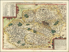
![Regionis Biturigum Exactiss: Descriptio Per D. Ioannem Calamaeum [with] Limaniae Topographia Gabriele Symeoneo Auct.](https://storage.googleapis.com/raremaps/img/small/61579.jpg)
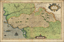
![(Berry, France) Biturigum provinciae quae Berrij : Vulgo dicitur chorographica descriptio [A chorographic description of the province of the Bituriges, which is called Berry by common usage.]](https://storage.googleapis.com/raremaps/img/small/92172.jpg)