|
||

|

|
|

|
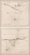
Fascinating map with fold-out tabs which extend the map to include parts of the Iberian peninsula and the subcontinent, blank verso.
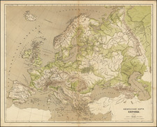
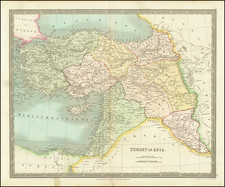
The borders post-date the second Anglo-Sikh War, are correct for the later stages of the Russo-Circassian War and pre-date Russian expansion into Independent Tartary. As Wyld appreciated, there was plenty of interest among his contemporaries in the various routes to India. In the mid 19th century the route pioneered by Thomas Fletcher Waghorn reduced the journey time between Britain and India to about 40 days (from three months or more which was usual at the beginning of the century).
However, the focus of the map is Central Asia, where the ‘great game’ between Russia and Britain was played out, and Wyld tapped in to his British audience’s growing fears of Russian expansion towards Afghanistan and India.
The map provides a marvelous overview of the various overland and water routes between England and India.
The primary routes shown are:
- Various Overland Routes via the Mediterranean and Red Sea
- Sea Route Via Mediterranean, Red Sea and Indian Ocean
- Sea Route Via Mediterranean, Gulf and Indian Ocean
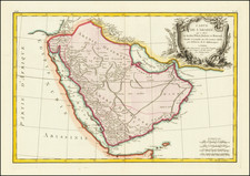
One of the more fascinating areas of detail can be seen in the Gulf, which includes excellent detail in the Emirates.
A number of place names are shown in Qatar, although Doha is not yet named (El Billah?).
Debai (Dubai), Aboo Heyle (Abu Dhabi) and Sharga (Sharjah) are shown, as are Oman and Muskat.
James Wyld Sr. (1790-1836) was a British cartographer and one of Europe’s leading mapmakers. He made many contributions to cartography, including the introduction of lithography into map printing in 1812.
William Faden, another celebrated cartographer, passed down his mapmaking business to Wyld in 1823. The quality and quantity of Faden’s maps, combined with Wyld’s considerable skill, brought Wyld great prestige.
Wyld was named geographer to Kings George IV and William IV, as well as HRH the Duke of York. In 1825, he was elected an Associate of the Institution of Civil Engineers. He was one of the founding members of the Royal Geographical Society in 1830. Also in 1830, his son, James Wyld Jr., took over his publishing house. Wyld Sr. died of overwork on October 14, 1836.
James Wyld Jr. (1812-87) was a renowned cartographer in his own right and he successfully carried on his father’s business. He gained the title of Geographer to the Queen and H.R.H. Prince Albert. Punch (1850) described him in humorous cartographic terms, “If Mr. Wyld’s brain should be ever discovered (we will be bound he has a Map of it inside his hat), we should like to have a peep at it, for we have a suspicion that the two hemispheres must be printed, varnished, and glazed, exactly like a pair of globes.”