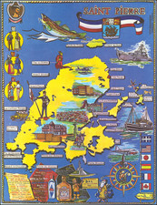
|
||

|

|
|

|
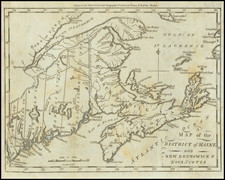
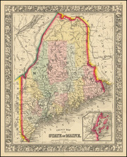
First state of this important map of the Lower Province of Canada and Maine, first issued by William Faden in 1813.
Faden map included information concerning over 100 land grants on either side of the St. Lawrence River, including the names of land owners. Faden's map showed the surveys conducted in 1796-98 along the Scoudiac and Magaguadavic Rivers, in order to ascertain the true location of the St. Croix River.
The second article of the Treaty of Peace between the US and Britain included the setting of the boundary between the two nations, " From the northwest angle of Nova Scotia, viz., that angle which is formed by a line drawn due north from the source of St. Croix River to the highlands . . ." It later became apparent that there was more than one St. Croix River. A further treaty provision in 1794 appointed a boundary commission which determined in 1798 that the intended St. Croix was the Scoudiac River and its northern branch Chiputneticook. The Treaty of Ghent, concluded on December 24, 1814, agreed to provide for a final adjustment of the boundaries described in the Treaty of 1783 that had not yet been determined, which included the boundary line from the source of the River St. Croix to the most northwestern point of the Lake of the Woods.
A further commission was appointed to settle the boundary from the St. Croix River to the St. Lawrence. Joseph Bouchette and John Lawrence were hired to conduct the surveys and submit the reports for resolution to a third nation. Ultimately, the issue was resolved by the Webster-Ashburton Treaty of 1842.
William Faden (1749-1836) was the most prominent London mapmaker and publisher of the late-eighteenth and early-nineteenth centuries. His father, William Mackfaden, was a printer who dropped the first part of his last name due to the Jacobite rising of 1745.
Apprenticed to an engraver in the Clothworkers' Company, he was made free of the Company in August of 1771. He entered into a partnership with the family of Thomas Jeffreys, a prolific and well-respected mapmaker who had recently died in 1771. This partnership lasted until 1776.
Also in 1776, Faden joined the Society of Civil Engineers, which later changed its name to the Smeatonian Society of Civil Engineers. The Smeatonians operated as an elite, yet practical, dining club and his membership led Faden to several engineering publications, including canal plans and plans of other new engineering projects.
Faden's star rose during the American Revolution, when he produced popular maps and atlases focused on the American colonies and the battles that raged within them. In 1783, just as the war ended, Faden inherited his father's estate, allowing him to fully control his business and expand it; in the same year he gained the title "Geographer in Ordinary to his Majesty."
Faden also commanded a large stock of British county maps, which made him attractive as a partner to the Ordnance Survey; he published the first Ordnance map in 1801, a map of Kent. The Admiralty also admired his work and acquired some of his plates which were re-issued as official naval charts.
Faden was renowned for his ingenuity as well as his business acumen. In 1796 he was awarded a gold medal by the Society of Arts. With his brother-in-law, the astronomer and painter John Russell, he created the first extant lunar globe.
After retiring in 1823 the lucrative business passed to James Wyld, a former apprentice. He died in Shepperton in 1826, leaving a large estate.