|
||

|

|
|

|
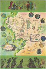
Intriguing genealogical tree, made during the last century of uninterrupted royal rule of France. The genealogy of the pre-Bourbon French dynasties is traced back for several dozen generations to a series of kings who supposedly lived in the second century. Many extinct lines of the family are shown, including the kings of Paris, the Kings of Aquitaine, and the "Western Emperors."
The work is further illustrated with many coats of arms at the top of the map. Four decorative prints in the bottom show some of the major Parisian residences of the kings of France. Three views of the Louvre are shown, including the gardens and the interior. An additional view shows the royal palace in the Bois de Vincennes, now in the 12th Arrondissement.
This map appeared in Chatelains Atlas Historique, one of the most extensive Dutch encyclopedias of the time.
Henri Abraham Chatelain (1684-1743) was a Huguenot pastor of Parisian origins. Chatelain proved a successful businessman, creating lucrative networks in London, The Hague, and then Amsterdam. He is most well known for the Atlas Historique, published in seven volumes between 1705 and 1720. This encyclopedic work was devoted to the history and genealogy of the continents, discussing such topics as geography, cosmography, topography, heraldry, and ethnography. Published thanks to a partnership between Henri, his father, Zacharie, and his younger brother, also Zacharie, the text was contributed to by Nicolas Gueudeville, a French geographer. The maps were by Henri, largely after the work of Guillaume Delisle, and they offered the general reader a window into the emerging world of the eighteenth century.
![(France) Gallia Antiqua Ex Aevi Romani Monumentis Eruta et Serenissimi Carnutum Ducis Munificentia Publici Juris Facta [Ancient Gaul From the Roman Age, the erudite Monuments. . .]](https://storage.googleapis.com/raremaps/img/small/82019.jpg)
![(Horse Diving) [Original photograph of Sonora Carver on her horse Red Lips in mid-air diving off a platform]](https://storage.googleapis.com/raremaps/img/small/96798.jpg)
![(World War II) [Iwo Jima Aerial Reconnaissance Photograph, March 8, 1945]](https://storage.googleapis.com/raremaps/img/small/83776.jpg)