The item illustrated and described below is sold, but we
have another example in stock. To view the example which
is currently being offered for sale, click the
"View Details" button below.


|
||

|

|
|

|
Stock# 7561
Description
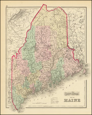
Beautiful and highly detailed map of Maine, colored by townships and showing outline borders for the counties. Also shows, railroads, stations, towns, rivers, lakes, islands, etc. The map curiously retains the 1855 J.H. Colton copyright date.
O.W. Gray Biography
O. W. Gray was a publishing firm based in Philadelphia. Later, they published as O. W. Gray & Son. They published atlases in the late nineteenth century. Gray's National Atlas was one of the most successful commercial ventures of the 1870s and one of the last to employ hand coloring on maps.

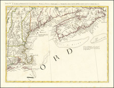
![Map of the States of Massachusetts, Connecticut and Rhode Island [Large Boston Inset]](https://storage.googleapis.com/raremaps/img/small/91825.jpg)
![(Rhode Island Coastal Defenses) [9 Engineering Plans for Barbette Batteries and Related Fortifications]](https://storage.googleapis.com/raremaps/img/small/92401.jpg)