This item has been sold, but you can enter your email address to be notified if another example becomes available.


|
||

|

|
|

|
Stock# 75533
Description
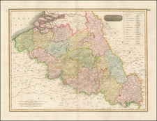
Scarce map of the provinces of Friesland, Drenthe, Overijssel, and Groeningen in the Netherlands, published by Cornelis De Jode.
The map is oriented with west at the top. This is one of the earliest printed maps to focus on this region.
Originally a separately issued map with a floral border, the border was subsequently trimmed (as here), for use of the map in De Jode's atlas.
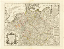
![[ Holy Roman Empire ] Nova Totius Germaniae Descriptio Geographica](https://storage.googleapis.com/raremaps/img/small/95672.jpg)