|
||

|

|
|

|
Only Known Example
Rare late-Lafreri School map of Piedmont and Liguria in northwesternmost Italy. With fantastic detail and attractive cartography, the map shows all the hallmarks of early Italian cartography: stippled oceans, decorative ships at sea, and rounded mountains.
According to Bifolco and Ronca, this is the hypothesized second state of a map that was likely first published around 1595, although no known examples have survived. The map is based on the circa 1595 Srechi and Valegio map of the region, although it is substantially expanded to the southeast, thus suggesting that this is based on some earlier, and now lost, map.
The map is oriented with the top to the east, with Genoa shown in the lower left of the map. Turin is visible along the River Po, and the enormous mountains of the Alps and Savoie are visible in the background of the map. Other cities named are Monaco, Nice ("Nizza"), Menton ("Mentone"),
The map includes a key indicating possession of the land, with eight different entities represented, highlighting the historically contested nature of this region. Each city and town has an associated lettering, and a detailed look at the map and the intertwining nature of claims reveals that any attempt to delineate boundaries would be nearly impossible to draw.
Rarity
This example was lent to Stanford for their exhibition on "Maps and Atlases from the Renaissance Period." Cited by Bifolco and Ronca. The first state of this map is only hypothesized to exist based on the style and content of the engraving.
The Lafreri School is a commonly used name for a group of mapmakers, engravers, and publishers who worked in Rome and Venice from ca. 1544 to 1585. The makers, who were loosely connected via business partnerships and collaborations, created maps that were then bound into composite atlases; the maps would be chosen based on the buyer or compiler’s interests. As the maps were initially published as separate-sheets, the style and size of maps included under the umbrella of the “School” differed widely. These differences can also be seen in the surviving Lafreri atlases, which have maps bound in with varying formats including as folded maps, maps with wide, trimmed, or added margins, smaller maps, etc.
The most famous mapmakers of the School included Giacomo Gastaldi and Paolo Forlani, among others. The School’s namesake, Antonio Lafreri, was a map and printseller. His 1572 catalog of his stock, entitled Indice Delle Tavole Moderne Di Geografia Della Maggior Parte Del Mondo, has a similar title to many of the composite atlases and thus his name became associated with the entire output of the larger group.
![(Padua, Vicenza, and Venice) Carte du Padouan, du Dogado, et de la plus grande partie du Vicentin, Dressée sur celle du Sr. Paul Barthelemi Clarici. [Map of Padua, the Dogado, and the Greater Part of the Vicenza, Based on that of Mr. Paul Barthelemi Clarici.]](https://storage.googleapis.com/raremaps/img/small/101488.jpg)

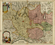
![Rhetiae alpestris descriptio in qua hodie Tirolis Comitatus [with] Goritiae, Karstii, Chaczeolae, Carniolae, Histriae, et Windorum Marchae Descrip.](https://storage.googleapis.com/raremaps/img/small/83989.jpg)
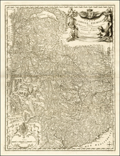
![[Corsica, Sardinia, Northern Italy]](https://storage.googleapis.com/raremaps/img/small/56055.jpg)