|
||

|

|
|

|
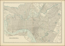
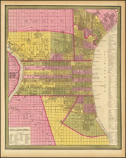
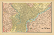
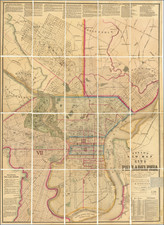
Impressive Civil War-era wall map of downtown Philadelphia with its suburbs and surrounding countryside. In the upper left, and inset shows all the streets, neighborhoods, and parks of Philadelphia in detail. Fourteen additional insets show the layouts of the cities and towns including those of Manayunk, Frankford, Germantown, and Bridesburg.
While the map is centered on Philadelphia, coverage extends approximately 25 miles in all directions. Many towns, features, roads, and more are named and shown.
The work is based on surveys compiled by Dunning J. Lake and Silas N. Beers, incorporating surveys by additional members of the Beers and Lake families. The first issue of this map appeared in 1860 and contained an additional imprint by C. K. Stone, although this imprint disappears in the presented 1861 edition.
Silas Beers was a New York mapmaker who spent most of his life as a farmer but turned to mapmaking to assist his brother, a civil engineer. Dunning Lake was an important Philadelphia civil engineer and map publisher who started by publishing special issue maps in 1860, thus this is one of his earliest maps.