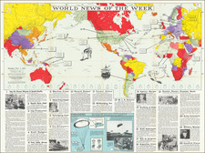
|
||

|

|
|

|
Scarce Hamburg-Amerikanische Packetfahrt-Aktien-Gesellschaft (HAPAG) wall map of the world designed and published for important Hamburg-American Line shipping corporation. The map includes incredible detail on a worldwide scale and shows the various lines operated by the company, including mail routes, pleasure cruises, and zeppelin airship services. A banner at the base of the map advertises health cruises. The map is incredibly detailed and large-scale, adding to the attractiveness of the item.
While the HAPAG corporation peaked prior to the First World War, the company retained its importance in the interwar years. The most famous lines operated by the company were the numerous zeppelin lines. The most notable of these routes was the LZ 127 Graf Zeppelin route which flew from Cadiz to Pernambuco (and later onwards to Rio de Janeiro; as shown on the map). This route served to connect German plantation owners in Brazil with the European continent. This route, along with many other Zeppelin routes, would be abandoned in 1937 following the disaster of the Hindenberg.
The map was published by Ravenstein's Geographische Verlagsanstalt, considered to be the second oldest publishing house in Germany.
Dating
The presence of the Graph Zeppelin Route connecting Germany and Brazil, alongside with a proposed onwards route to Buenos Aires, dates the map to either 1931 or 1932.

![[ Sun Valley Ski Map ]](https://storage.googleapis.com/raremaps/img/small/101431.jpg)
![Western Hemisphere [and] Eastern Hemisphere](https://storage.googleapis.com/raremaps/img/small/90387.jpg)