This item has been sold, but you can enter your email address to be notified if another example becomes available.


|
||

|

|
|

|
Stock# 74174
Description
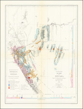
Scarce map of Utah, Colorado, Arizona, and New Mexico, hand-colored by counties.
Includes substantial details in each of these then territories of the US, including towns, mountains, rivers, Forts, Indian Villages, early railroads and proposed railroad routes, and many many other details. From HH Lloyd's scarce Atlas of the US, which only appeared as a supplement to Beers County Atlases in the early 1870s.
Condition Description
Original hand-color.
![Map of the Missouri Pacific and St. Louis, Iron Mountain and Southern Railway and Connections [Missouri Pacific Railway. St. Louis & All Points East Chair Cars Free Fast Mail Route]](https://storage.googleapis.com/raremaps/img/small/91606.jpg)
![[ Southern Railroads ] Railroad Map of the Southern States Shewing the Southern & Southwestern Railway Connections With Philadelphia. 1862 . . . Prepared by Thomas Kimber Jr., Chairman of the Committee on Inland Transportation of the Board of Trade of Philadelphia](https://storage.googleapis.com/raremaps/img/small/103211.jpg)