|
||

|

|
|

|
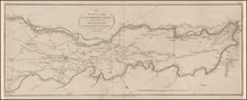
Hungarian Expedition to the Manchu Empire
Rare English language map illustrating the route of the expedition led by Count Béla Széchenyi.
The map is based on the topographical measurements by Gustav Kreitner and the geological investigations by L. Lóczy, both of whom joined in the expedition with Széchenyi.
This completely unknown map is much more detailed and larger in format than the overview map of the travel book of the German version "Atlas zur Reiseroute in Ost-Asia", published 1893-1899. The map was likely intended for a report of the expedition in English which was not published.
It is noteworthy that the map was published in 1883, nearly a decade before the full official report of the expedition.
Hungarian Expediton to the Manchu Empire
From 1877 to 1880 Count Béla Széchenyi (1837-1918), son of István Széchenyi, founder of the Hungarian Academy of Sciences, organized and led the first Hungarian expedition to the Manchu Empire. This undertaking became appreciated mostly for the geological, paleontological and geographical investigations of one of its members, Lajos Lóczy. The three scholarly members of the expedition were Austrian cartographer lieutenant Gusztáv Kreitner (1847-1893), the linguist Gábor Bálint of Szentkatolna (1844-1913) who, however, was forced to turn back by his illness, and the geologist and geographer Lajos Lóczy (1849-1920).
In the fieldwork, Lóczy played the main role, and the most important scholarly results of the expedition concerning the geomorphology and paleontology of Central Asia and Western China are linked to his name. He edited the scientific results of the expedition in the three volumes entitled “Gróf Széchenyi Béla keletázsiai utazásának (1877-1880) tudományos eredményei” (Scholarly results of the Eastern Asian travel of Count Béla Széchenyi), containing the contributions of twenty Hungarian and foreign scholars. The renowned geographer Ferdinand von Richthofen, who in 1877 coined the term “Silk Road” (Seidenstrasse), regarded the essays by Lóczy in these volumes as masterpieces of geological studies.
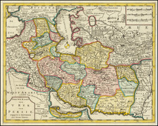
The expedition traversed the Chinese-Tibetan mountain regions. After they had crossed China from Shanghai to Lanchow, they concentrated on the exploration of the Tibetan mountain ranges facing towards the Gobi desert, a region which had never previously been studied by a geologist. The expedition touched on the northern edge of Nan-shan, the ranges of the Middle Kun-lun between Lan-tschóu, the eastern edge of Kuku-nor and the Hwang-ho, and the eastern and southeastern part of the Tibetan Plateau, and finally West Sz'tschwan and Young nan. According to Yakushi the route included Suchow, Kumbum monastery, Sining, Hami, Turfan, Karashar, Eastern Tibet and Burma.
Among the observations made by Loczy was the observation of extensive Pleistocene glaciation on the Sino-Tibetan borderlands.
The scientific results of the expedition were published in Hungarian in three volumes in 1890-1897, their German translation appeared in 1893-1899.The linguist of the expedition Gábor Bálint of Szentkatolna left the group for health reasons early on in Bombay, so the linguistic observations on Amdo Tibetan were made by Béla Széchenyi himself. Though Tibet proper was on the expedition’s itinerary, due to various difficulties the travelers never succeeded to get there. Nevertheless, they met Tibetans along their way in the Kukunor region and in Kansu.
Bela Szechenyi
Count Bela Szechenyi was the first-born son of Count István Széchenyi, an iconic figure of Hungary's Age of Reform in the 1820s to 1840s. Following Hungary's defeat in the 1848–9 Revolution and War of Independence against the Habsburgs, his father István was locked up in a mental asylum outside Vienna, where he committed suicide in 1860. Unlike his father in the 1820s, Béla was allowed to travel. He traveled to the United States during the Civil War and made a Grand Tour in Germany, England, France and Spain. He visited Algiers in 1865 and between 1877 and 1880, he traveled to China and Southeast Asia, accompanied by Kreitner and Loczy.
Rarity
The map is very rare. The map is not in the map collection of the Austrian National Library or in the archives of the Austrian Geographical Society and not in the map collection of the Royal Geographical Society.
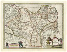
![[ Szechwan and Hunan Provinces ] Hunouang, e Sucuhen, Provincie della China . . .](https://storage.googleapis.com/raremaps/img/small/43950.jpg)
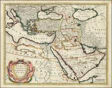
![Turkey in Asia [Including Cyprus]](https://storage.googleapis.com/raremaps/img/small/98704.jpg)