This item has been sold, but you can enter your email address to be notified if another example becomes available.


|
||

|

|
|

|
Stock# 73653
Description
Scarce map of Cleveland, Ohio, issued by the Cleveland News Company in 1898.
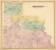
The map goes as far east as Glenville, East Cleveland, and Euclid Heights. In the west, it goes to Brooklyn Township.
The map is hand-colored by wards, with additional differentiation of "Street Railways" and "Steam Railroads".
The map was copyrighted and lithographed by A.H. Mueller of Philadelphia.
Condition Description
Folding map. Minor toning, more noticeably at the upper edge.