


|
||

|

|
|

|
A Texas Rarity -- House & Brown's Mexican War Map
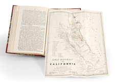
Nice example of the rare first state of House & Brown's Mexican War era map of Upper California, Texas, Mexico and the Southwest, which includes the Spanish Trail, Trader's Route to Independence and several other important western routes.
The map was inspired by SA Mitchell's map covering a similar area in 1846. While the map was initially an attempt by House and Brown and the Kellogg lithographic firm (who have been called the Currier & Ives of Connecticut) to create their own copy of Disturnell’s treaty map and Mitchell’s Mexican-American War Map of Mexico, including Yucatan & Upper California, the map would go on to have a life of its own in a number of editions and with significant revisions over the next 4 years, capitalizing on the Gold Rush and interest in the American West.
Six battle fields in Texas are noted, including Alamo, San Jacinto, Palo Alto, Resaca de la Palma, Buena Vista, and Monterey. In addition to these features, which are copied from Mitchell, an elaborate view of the Castle of San Juan D'Ulloa is shown.
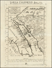
The map illustrates Texas just after it had attained its statehood in 1846, with its claims to regions to the north still prominently shown in this "Stovepipe" configuration.
In California, The Great Spanish Trail to Santa Fe is prominently shown, as is Sutter's New Helvetia, which would be the site of the discovery of gold the following year in 1848.
Rarity
The map is very rare.
A second state of the map was issued in 1849, highlighting in Yellow the Gold Regions of California with the date of 1849 added and significant topographical detail from Fremont and other sources added in California.
A third state of the map was issued by House & Brown in 1849, with revised Texas borders and showing New Mexico and Utah, rather than Upper California.
A fourth state of the map was issued by House & Brown in 1849, with revised Texas borders and showing New Mexico and Utah, rather than Upper California.
![Texas and Mexico, in 1846; Comprising the History of Both Countries, with an Account of the Soil, Climate, and Productions of Each [with map:] Mexico & Texas in 1846. Seat of War.](https://storage.googleapis.com/raremaps/img/small/100804.jpg)
![[Mexico and Central America with Baja California inset, from Generalkarte von Nord America samt den Westindischen Inseln Versasst von Herrn. Pownall . . . MDCCLXXXVIII]](https://storage.googleapis.com/raremaps/img/small/95064.jpg)