|
||

|

|
|

|
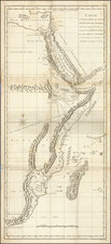
Striking Map of Ancient Palestine
Scarce map of Ancient Palestine, published by Henry Teesdale of London.
The map is colored to show the 12 Tribes of Israel, with ancient placenames.
Includes an inset plan of Jerusalem.
Teesdale was a London-based map publisher. He was an early Fellow of the Royal Geographical Society, elected in 1830. Teesdale partnered with John Hordan and William Colling Hodson, but this arrangement dissolved in 1832. Afterward, he continued to work on his own and periodically with colleagues like John Crane Dower, Christopher Greenwood, Josiah Henshall and others. He published a variety of atlases and separately-issued maps. His business was quite successful, as he registered as a partner in the Royal Bank of Scotland in 1845.
![[ Descendants of Noah ] Table historique du second age du monde tiree de la Genese...](https://storage.googleapis.com/raremaps/img/small/82009.jpg)
![Terra Sancta sive Palaestina exhibens non solum Regna Vetera Iuda et Israel in Suas XII Tribus Distincta . . . 1759 [The Holy Land, or Palestine, displaying not only the ancient kingdoms of Judah and Israel divided into their Twelve Tribes... 1759]](https://storage.googleapis.com/raremaps/img/small/90182.jpg)