


|
||

|

|
|

|
Gold Mining Near the Mount Baker Ski Area
Rare blue printed map of the mining regions of the Mt. Baker or Nooksack Mining District.
The map was drawn by a young Oliver P. Anderson, who would go on to become of the most influential Washington mapmakers, and published her by the Kroll Map Company, who has added their label to the map.
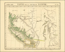
Centered on the area north of Mount Baker and the region around the Nooksack River, the concentration of gold mining is in the area northwest of Ruth Mountain and Mt. Shuksan
Nooksack Mining District
In 1896 the first significant discovery of lead, zinc, and silver was made in what was then known as the Shuksan or the Nooksack mining district of western Whatcom County. Near the 18 mile post on the Cascade State Trail, H. C. Wells discovered the Silver Tip vein. This discovery was followed by discoveries of gold bearing quartz to the east along the Trail, as well as in the surrounding area.
On August 23, 1897, the most important discovery of gold in the Mount Baker area was made by Jack Post, of Sumas. While prospecting with R. S. Lambert and L. G. Van Volkenberg, Post discovered the Lone Jack vein, on the southern slope of Bear Mountain above the West Fork of Silesia Creek. Gold-bearing quartz from the discovery assayed as high as $10,000 per ton, and a gold rush followed; Sumas became the main outfitting
town.
In the Nooksack mining district, tent cities of miners sprang up almost overnight. Gold Hill was established at the present site of Shuksan; Trail City was
2 miles east, at Swamp Creek; Wilson's Townsite was at the confluence of Ruth Creek and the Nooksack River; Gold City was at the 18 mile post on the Cascade Trail; and Union City was at the headwaters of Swamp Creek.
In 1898, at a miners' meeting in Sumas, the Mount Baker mining district was established. At that time, claim staking in western Whatcom County was not confined to the upper reaches of the North Fork of the Nooksack River. In the vicinity of Baker Lake, prospectors roamed the hills, and many claims were recorded in New Whatcom. The most well known prospector of the Baker Lake area was Joseph Morovits, who staked many claims south of Mount Shuksan and east of Mount Baker and established a homestead north of Baker Lake.
Blueprint maps
Blueprint maps were among the most popular means for the swift printing of maps for which there would be a limited demand. A blueprint map could be made and/or revised much more quickly than a lithograph, cerograph, or other printing method, and at a much lower cost.
Blueprinting as a method was invented in 1842 by John Herschel, a chemist, astronomer, and photographer. A cyanotype process, one starts by drawing on semi-transparent paper, weighted down by a top sheet of paper. The paper would be coated with a photosensitive chemical mixture of potassium ferricyanogen and ferric ammonium citrate. The paper would then be exposed to light, wherein the exposed portions turned blue and the drawn lines, protected from exposure, would remain white.
The blueprint process was an improvement on the expensive and time-consuming method of hand-tracing original documents. The technique was particularly popular with architects; by the 1890s, a blueprint was one-tenth the cost of a hand-traced reproduction. It could also be copied more quickly.
Blueprint maps began to appear as early as the 1850s and 1860s, but they really began to become the standard for mining and similar limited-purpose maps by the 1880s. The ability to create these maps quickly and at a low cost made them the standard for short-run prints, ideal for mapping mining regions in the West and for similar purposes.
The method still exists today, but in a very limited fashion. In the 1940s, diazo prints (whiteprints or bluelines) became more popular, as they were easier to read and faster to make. The blue lines on a white background of these prints are now what most people call blueprints.
Rarity
The map is apparently unique.
Oliver Phelps (O.P. Anderson) is one of Seattle's first indigenous map publishing companies. Anderson was an amateur photographer and owner of a photographic supplies business in Seattle in the early 1900s. Anderson first worked as a bookkeeper in Seattle in the early 1880s, though by the end of that decade he was doing business as a draughtsman.
The earliest maps bearing Anderson's name appear in about 1885, including the name "Anderson Brothers." Most of these early maps are blue print maps, a style of mapmaking which was becoming more common in the 1880s with publishers looking to produce fast inexpensive maps that were quickly and easily updateable. This form of map was very popular in the west, where the rapid growth of communities, train lines and mining regions were especially robust. The first map jointly issued by Anderson and Whitworth & Thomson was West Seattle five acre tracts . . ., blue print map of a hand drawn plat map from the records of Kings County, circa 1885.
Anderson formed his civil engineering and map publishing business, O.P. Anderson & Co., in the early 1890s, with the business changing its name to the O.P. Anderson Map & Blue Print Co. by the mid 1890s. Beginning around 1900, Anderson began selling photographic supplies as president of Anderson Supply Co., located at 111 Cherry Street in Seattle.
Around 1913, Anderson's son, Maurice P. Anderson, took over as president of the company, and Anderson acted as secretary-manager, a position he continued to hold until around 1940, probably until his death. Anderson Supply Co. continued to do business, with Maurice Anderson as president, until the late 1950s.
![[Alaska to San Diego and San Qunitin, British Columbia] A Chart Shewing Part of the Coast of N.W. America, with the Tracks of His Majesty's Sloop Discovery and Armed Tender Chatham . . . (First Modern Map of the West Coast of North America)](https://storage.googleapis.com/raremaps/img/small/102067.jpg)
![[ Early Automobile Tourism -- Pacific Coast Highways ] (Strip Maps, etc.)](https://storage.googleapis.com/raremaps/img/small/81461.jpg)