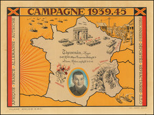
|
||

|

|
|

|
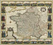
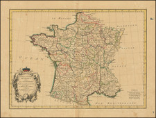
Spectacular Original Color
Final original color example of this decorative map of the region around Paris, by one of the leading map makers in Paris during the late 17th and early 18th Centuries.
The map is centered on Paris and extend to Champaigne, Rouens, Montreaux, Fountainblaeu and Courville.
Tremendous detail, including the smallest towns, churches, roads, rivers, lakes and other minor details.
Pierre, or Pieter, Mortier (1661-1711) was a Dutch engraver, son of a French refugee. He was born in Leiden. In 1690 he was granted a privilege to publish French maps in Dutch lands. In 1693 he released the first and accompanying volume of the Neptune Francois. The third followed in 1700. His son, Cornelis (1699-1783), would partner with Johannes Covens I, creating one of the most important map publishing companies of the eighteenth century.