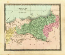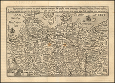


|
||

|

|
|

|
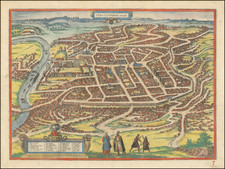
Fine example of Braun & Hogenberg's view of Vilna in Lithuania, from Braun & Hogenberg's Civitates Orbis Terrarum, the most famous and influential book of town plans published in the 16th Century.
Striking view of Vilna, illustrating its strategic location on the Wilde River, an important crossing on the ancient east-west trade route. The large warehouse complex with numerous haus is located along the river reflecting the city's importance within the Hanseatic League. Among the mostly wooden buildings, are the masonry Ancient Castle (#1 on the key), Imperial Palace (#3), Stanislas Cathedral (#4), St. John's Cathedral (#14), and the Gothic Churches of St. Anna and St. Bernard (#12). The city is completely enclosed within heavily fortified masonry walls.
The view is taken from a drawing by Flemish artist, Guillebert de Lannoy, who visited the city in 1414. Much of the city had been rebuilt in stone and brick by the time this view was first published in 1581 in the Civitates orbis terrarum.
Georg Braun (1541-1622) was born and died in Cologne. His primary vocation was as Catholic cleric; he spent thirty-seven years as canon and dean at the church St. Maria ad Gradus, in Cologne. Braun was the chief editor of the Civitates orbis terrarum, the greatest book of town views ever published. His job entailed hiring artists, acquiring source material for the maps and views, and writing the text. In this role, he was assisted by Abraham Ortelius. Braun lived into his 80s, and he was the only member of the original team to witness the publication of the sixth volume in 1617.
Frans Hogenberg (ca. 1540-ca. 1590) was a Flemish and German engraver and mapmaker who also painted. He was born in Mechelen, south of Antwerp, the son of wood engraver and etcher Nicolas Hogenberg. Together with his father, brother (Remigius), uncle, and cousins, Frans was one member of a prominent artistic family in the Netherlands.
During the 1550s, Frans worked in Antwerp with the famous mapmaker Abraham Ortelius. There, he engraved the maps for Ortelius’ groundbreaking first atlas, published in Antwerp in 1570, along with Johannes van Deotecum and Ambrosius and Ferdinand Arsenius. It is suspected he engraved the title page as well. Later, Ortelius supported Hogenberg with information for a different project, the Civitates orbis terrarium (edited by Georg Braun, engraved by Hogenberg, published in six volumes, Cologne, 1572-1617). Hogenberg engraved the majority of the work’s 546 prospects and views.
It is possible that Frans spent some time in England while fleeing from religious persecution, but he was living and working in Cologne by 1580. That is the city where he died around 1590. In addition to his maps, he is known for his historical allegories and portraits. His brother, Remigius, also went on to some fame as an engraver, and he died around the same time as his brother.