This item has been sold, but you can enter your email address to be notified if another example becomes available.


|
||

|

|
|

|
Stock# 71353
Description
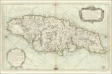
Rare harbor chart of Port Royal, Jamaica, published in London by John Luffman.
The map shows Salt Pond Hill, Road to Spanish Town, Passage Fort, Port Royal, Kingston, New Greenwich, Rock Fort, etc. Includes soundings, roads and other information for mariners.
The text at the bottom notes:
Port Royal Harbour is as secure as any in the world, 1000 ships may ride therein in safety in the worst weather. The Town was destroyed by an earthquake in 1692, by fires in 1702 & by an inundation in 1722. Late. 17 N. Longe. 76.54 W. from London.
This is one of the nicer maps of Kingston and Port Royal to have been published at the beginning of the 19th century.
Condition Description
Original hand-color in full.

![Cuba, Jamaica and Porto Rico [Cayman Islands]](https://storage.googleapis.com/raremaps/img/small/78708.jpg)
![Cuba Insula [with] Hispaniola Insula [with] Insula Jamaica [with] Ins. S. Ioannis [with] I.S. Margareta Cum Confiniis](https://storage.googleapis.com/raremaps/img/small/95802.jpg)