


|
||

|

|
|

|
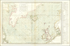
An Important British Admiralty Polar Chart
Rare separately published map of the Polar regions, published on June 29, 1835 in London by the British Admiralty. The present example is updated to 1849, which seems to be the the edition ordered for publication by Parliament in April 1848.
Circular Admiralty chart of the North Polar Sea, with the North Pole at the center and extending to 60°N, showing the northern coasts of North America, Europe and Asia. North America is shown from the Bering Straight and the Mackenzie River in the west over to Hudson's Bay, the Parry Islands, Cockburn Island, Melville Peninsula, Fox Channel, and Hudson Straight. Continues to Baffins Bay and Davis Straight, Greenland, Iceland, Spitzbergen, Norway, Lapland, and over to the Russian Arctic. Oriented with Greenwich meridian at the bottom, the map covers the Arctic Ocean and Arctic landmasses adjacent to it.
The Hydrographic Office of the Admiralty first produced this chart of the North Polar Sea in 1835 to reflect the latest discoveries in the Arctic. The notation “loam of the land” marks the spot where William Parry and his crew believed they had spotted land that, as it turned out, did not actually exist. This phenomenon, called a Fata Morgana or Arctic mirage, is a common occurrence in Polar expeditions.
This example includes a meticulous hand drawn grid, drawn in pencil and red pen. This chart was utilized by the British Admiralty and the Hydrographical Office to record the progress of explorations after 1835. While the chart is a very rare survival, several of the surviving example are annotated to show the results of subsequent explorations:
- National Maritime Museum (annotated with exploration routes up to 1848 and ordered for publication by Parliament on April 13, 1848: https://collections.rmg.co.uk/collections/objects/262573.html
- National Maritime Museum (inscribed from Captain Beaufort to Eleanor I. Franklin: https://collections.rmg.co.uk/collections/objects/262575.html
There exists in the National Maritime Museum and earlier printed version of the map dated 1818.
British Charting of the Atlantic
In 1818, The British Admiralty decided to undertake the exploration and charting of the Arctic. Explorers had determined by 1818 that there was no practical Northwest Passage, but growing scientific curiosity, and national pride, demanded that the blank northern area on the maps be filled in.
Between 1818 and 1847, a two-pronged approach was launched into the Arctic by sea and over land. The sea expeditions, chiefly those led by John Ross and William Edward Parry, evaluated the Eastern access points and reached the conclusion that Lancaster Sound was the main entry to further exploration. Theirs were also the first Arctic expeditions to make extensive observations of the Inuit and to make use of Inuit mapping skills.
The main overland expeditions were by John Franklin and George Back (1833-37) and -- sponsored by the Hudson's Bay Company -- Peter Warren Dease and Thomas Simpson (1837-39) and John Rae (1846-47). These journeys charted the northern limits of the Canadian mainland from the Foxe Basin to Alaska. Rae's expedition also showed what a small group of men living off the land could accomplish, in contrast to the massive undertakings sponsored by the Admiralty. Between 1818 and 1847 a large part of the blank areas in maps of Canada had been filled.
In 1845, the attention of the Admiralty shifted again to a major sea expedition, with John Franklin in command of 129 men in two ships. In 1847, when nothing had been seen or heard of them, the first search expedition was sent out. By 1854, after 65 major and minor searches had been undertaken, John Rae returned with proof of a major Franklin disaster. Ten expeditions later, Francis Leopold McClintock confirmed the likelihood that there were no Franklin survivors. An accomplishment of these search expeditions was the charting of the Arctic Islands to 125° west longitude and 78° north latitude.
After 1860, as further geographical details were being filled in around the Arctic Islands, attention shifted to the North Pole. Major American, British and Norwegian expeditions made an attempt to be the first to arrive there. Finally, the American Robert Peary claimed to have reached the Pole on April 6, 1909.
Rarity
The chart is very rare.
OCLC locates 2 examples of the 1835 edition (Library of Congress and University of Wisconsin, Milwaukee (American Geographical Society copy).
OCLC locates 1 example of the 1847 edition (British Library)
OCLC locates 3 examples of the 1849 edition (Royal Danish Library, University of Alaska, Fairbanks, Bibliotheque National de France)
The British Admiralty has produced nautical charts since 1795 under the auspices of the United Kingdom Hydrographic Office (HO). Its main task was to provide the Royal Navy with navigational products and service, but since 1821 it has also sold charts to the public.
In 1795, King George III appointed Alexander Dalrymple, a pedantic geographer, to consolidate, catalogue, and improve the Royal Navy’s charts. He produced the first chart as the Hydrographer to the Admiralty in 1802. Dalrymple, known for his sticky personality, served until his death in 1808, when he was succeeded by Captain Thomas Hurd. The HO has been run by naval officers ever since.
Hurd professionalized the office and increased its efficiency. He was succeeded by the Arctic explorer Captain William Parry in 1823. By 1825, the HO was offering over seven hundred charts and views for sale. Under Parry, the HO also began to participate in exploratory expeditions. The first was a joint French-Spanish-British trip to the South Atlantic, a voyage organized in part by the Royal Society of London.
In 1829, Rear-Admiral Sir Francis Beaufort was appointed Hydrographer Royal. Under his management, the HO introduced the wind force scale named for him, as well as began issuing official tide tables (1833). It was under Beaufort that HMS Beagle completed several surveying missions, including its most famous voyage commanded by Captain FitzRoy with Charles Darwin onboard. When Beaufort retired in 1855, the HO had nearly two thousand charts in its catalog.
Later in the nineteenth century, the HO supported the Challenger expedition, which is credited with helping to found the discipline of oceanography. The HO participated in the International Meridian Conference which decided on the Greenwich Meridian as the Prime Meridian. Regulation and standardization of oceanic and navigational measures continued into the twentieth century, with the HO participating at the first International Hydrographic Organization meeting in 1921.
During World War II, the HO chart making facility moved to Taunton, the first purpose-built building it ever inhabited. In 1953, the first purpose-built survey ship went to sea, the HMS Vidal. Today, there is an entire class of survey vessels that make up the Royal Navy’s Hydrographic Squadron. The HO began to computerize their charts in the late 1960s and early 1970s. In 1968, the compilation staff also came to Taunton, and the HO continues to work from there today.
![[Parts for a Klinger globe]](https://storage.googleapis.com/raremaps/img/small/46375.jpg)
![[English Edition!] Maris Pacifici quod vulgo Mar del Zud](https://storage.googleapis.com/raremaps/img/small/71000.jpg)

![[Spitzbergen & Wiches Lande]](https://storage.googleapis.com/raremaps/img/small/61990.jpg)