|
||

|

|
|

|
Stock# 70051
Description
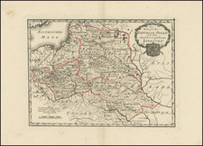
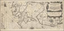
Rare engraved map of central Estonia north of Lake Võrtsjärv covering parts of present-day Järva, Viljandi, Tartu, and Jõgeva Counties.
The map features an attractively-engraved coat of arms of Viljandi Kreis, a province in Livoniain the 18th and 19th centuries.
This map was included in Ludwig August Mellin's Riga-published Atlas von Liefland, oder von den beyden Gouvernementern u. Herzogthümern Lief- und Ehstland, und der Provinz Oesel.
This example of the map was never bound in an atlas, instead being mounted on linen for individual use.
Condition Description
Folding map dissected in 18 parts and laid on original linen. Original outline hand-color.