|
||

|

|
|

|
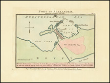
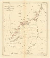
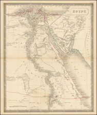
Egypt During the Anglo-Egyptian War
Detailed military reconnaissance map of the Lower Nile Delta, published by the British War Department.
The map extends from Cairo in the South, to Alexandria and Port Said in the north, and includes significant topographical information.
At the lower left is a large city plan of Cairo, with a plan of Alexandria at the top left and a plan of Ismaila at the lower right.
The map depicts the region during the The British Conquest of Egypt, also known as Anglo-Egyptian War, which was fought in 1882 between Egyptian and Sudanese forces under Ahmed ‘Urabi and Great Britain. It ended a nationalist uprising against the Khedive Tewfik Pasha and established firm British influence over Egypt at the expense of the Egyptians, the French and the Ottoman Empire, which retained only nominal authority.
![[Middle East, Central Asia & Indian Ocean]](https://storage.googleapis.com/raremaps/img/small/92812.jpg)