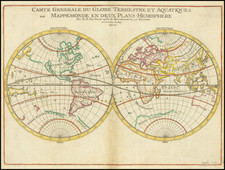
![[Volcanos and the Subterranean World] Tabula Geographico-Hydrographica Motus Oceani, Currentes, Abyssos, Montes Igniuomos In Universo Orbe Indicans, Notat Haec Fig. Abyssos Montes Vulcanios By Athanasius Kircher](https://storage.googleapis.com/raremaps/img/small/95720.jpg)


|
||

|

|
|

|
Fascinating World Map Showing Entrances to a Subterranean Realm
Striking seventeenth-century map of the world, prepared to illustrate Athanasius Kircher's fascinating work on the underground passages and subterranean networks of the globe. Kircher’s maps are some of the first thematic maps.
Shown on a Mercator projection, the continents are splayed widely, displaying with their great abysses and volcanoes, each of which has a specific symbol noted with the title at the top. Abysses, chasms or whirlpools leading to underground rivers and reservoirs, are in the world’s oceans and lakes; a few volcanoes are also in the seas.
Meant to explain Kircher’s theories, not communicate geographic intricacies, there is little inland detail beyond continental names. This is one of the first maps to show oceanic currents, which are marked with hachures.
The North Pole is shown covered in a large landmass or ice sheet, while the South Pole is home to a massive Terra Australis Incognita. New Guinea and the Straits of Magellan are prominent.
Mundus Subterraneus
The map comes from Kircher’s famous work, Mundus Subterraneus, which explored the subterranean world. Kircher was deeply interested in the unseen workings of the underground world. He had researched volcanoes extensively, observing eruptions at Etna and Stromboli. He also had himself lowered into the crater of Vesuvius to view the effects of an eruption, only years after the volcano had killed over 4,000 people in an explosion.
These observations led Kircher to develop theories about the world’s underground, arguing that subterranean passages fed the world’s volcanoes via sulphurous spirits. There were supposedly rivers and streams under mountains ranges; these linked with the world’s oceans. The swirling waters fed the fires of the volcanoes, while the fires kept the water from freezing; mountains were reservoirs for these forces.
The center of this global network was a massive whirlpool off of Norway (there actually is a whirlpool system in this area, the Moskenstraumen), where water entered the system. It exited near the South Pole. Giants had once lived in these underground chambers, and dragons still supposedly dwelled there.
These ideas were gathered in Mundus Subterraneus, a two-volume treatise and atlas published in Amsterdam in 1665. Vol. I explained “the admirable structure of the terrestrial globe”, while vol. II told people how to capitalize on the world’s resources. Together, the books laid “before the eyes of the curious reader all that is rare, exotic, and portentous contained in the fecund womb of Nature.”
In addition to ideas about spontaneous generation of animals and diatribes against mendacious alchemists, as well as ideas about the location of the lost island of Atlantis and the source of the Nile, there are charts showing the currents of the subterranean passages. These were some of the first charts to show oceanic currents, albeit in a fantastic way. The books also included a series of lunar maps and continental maps like this one that showed the connections between subterranean and surface waterways.
Athanasius Kircher (1601-1680) was a Jesuit priest and a well-respected scholar known for his role in disseminating knowledge. Kircher was educated in Greek, Hebrew, and the humanities at Fulda, Paderborn, Cologne, Koblenz, and Mainz. After fleeing the Thirty Years’ War in Germany, Kircher worked as an academic at Avignon and, from 1634, Rome.
In Rome, Kircher served as an intellectual node, spreading information sent from around the world by Jesuit missionaries. Particular interests included ancient Egypt, astronomy, mathematics, medicine, music, and languages (both ancient and modern). He also made several maps and was a geographic compiler. It is likely he was the first person to depict the Pacific Ring of Fire on a map.
Kircher combined a mixture of hermeticism with nascent scientific inquiry, gaining him a reputation as one of the final Renaissance men. For example, he observed the eruptions of Etna and Stromboli. He had himself lowered into the crater of Vesuvius soon after an eruption to observe the changes wrought by the cataclysm. He experimented with bioluminescence by seeking the applications of firefly extract as a light source. He also made the first known Aeolian harp.
Kircher wrote 44 books, while over 2,000 of his manuscripts and letters survive. He also assembled one of the first natural history collections, the Museo Kircheriano or the Kircherianum, which was broken up after his death and became the foundation of several institutional collections.
![[ Genesis / Creation ] De Schepping der Wereldt Volgens de Beschryving van Mozes. 1 Plaat [in set with] De Schepping der Wereldt Volgens de Beschryving van Mozes. 2. Plaat](https://storage.googleapis.com/raremaps/img/small/101543.jpg)