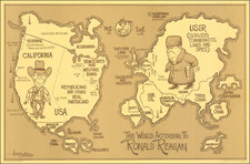
|
||

|

|
|

|
Rare birds-eye pictorial view of Phoenix, Arizona, by Don Bloodgood, one of the American Southwest's greatest pictorial mapmakers.
The view was published as a promotional pamphlet for Phoenix in 1956. The cover title is "A Pic-Tour Map of Phoenix... Where to go... What to do... How to see The Valley of the Sun".
The map looks north over Phoenix from just south of the Salt River Basin in a theoretical spot in the Salt River Mountains.
The city itself is shown in surprising detail with many of the landmarks labeled. The outskirts of the metropolitan area are surrounded by orchards and other agricultural operations. Airports such as Sky Harbor, Paradise, Phoenix Air Haven, and Luke Air Force Base are illustrated.
The map was made during Phoenix's most explosive period of growth; from a population of just over 100,000 in 1950, the city grew to 439,170 in 1960, an astounding 311% growth.
Camel Back Mountain and Squaw Peak are shown, along with the adjacent Paradise Valley Country Club.
The verso features color photographs of local landmarks with explanatory captions. The buildings include some in the quintessential Southwestern mid-century style so closely associated with Phoenix. The Tovrea Stockyard is illustrated - at the time the map was made it was the largest feedlot in the world.
The map is rare; this is the first time we have had it.