|
||

|

|
|

|
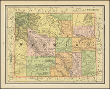
Fabulous map of Montana, Idaho and Wyoming on a horizontal format, featuring a 5 county Wyoming and early configurations of Idaho and Montana.
This is the third state of the map of which we are aware, each with a slightly different title. The earliest is dated 1872, with a subsequent undated example employing substantially the same plate and both depicting 4 counties in Wyoming. This 3rd state is a completely updated plate, with 5 counties in Wyoming and significantly more cartographic and topographic detail.
The area around Yellowstone has been completely redone and a number of new mountain ranges are shown, as are several new counties. Shows the Overland Route to the Gold Fields, the Emigrant Road, and a host of other early roads, railroads, mines, Forts, Indians Tribes, etc. Locates Yellowstone, although the Tetons are not shown. One of the best and scarcest commercial atlas maps of this region. HH Lloyd's Atlas of the United States was never issued as a separate Atlas. Its only appearance is as a supplement to County and State atlases published by Warner & Beers.
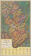
![Jackson's Hole Wyoming [Dude Tips]](https://storage.googleapis.com/raremaps/img/small/90393.jpg)
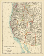
![[Idaho and western parts of Wyoming & Montana--including Yellowstone and Tetons] Amer. Sep. No. 39. Partie Des Etats-Unis](https://storage.googleapis.com/raremaps/img/small/93545.jpg)