|
||

|

|
|

|
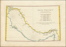
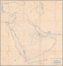
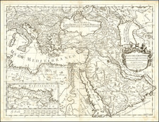
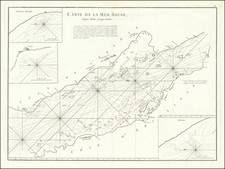
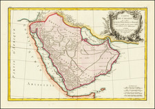
This is a rare map of the Arabian peninsula that appeared in Geographi Graeci minores. Tabulae di Karl Otfried Müller. The map shows the extent of the regions now part of Oman and Yemen inland as far as could be identified from a ship. Major cities, waterways, mountains, and other important geographical and navigational features of the area are shown.
Karl Muller's Geographi Graeci minores appears to be a partial attempt to collect the vast geographical knowledge of the Greeks. Herein he describes provides some new translations, describes the knowledge of the ancients, and compares his findings to modern geography. The work was published at a time when the studies of the ancient world were just starting to be done in a modern fashion.
Works such as Muller's are an often-underutilized source of knowledge regarding the antiquities. Fenet states that "The majority of the nautical voyages collated by Muller need modern and detailed commentary. Recent publications have started to use these types of sources more frequently." In all, this is work and map were an important early modern study on the subject.