
The Enlarged 1578 Edition of Munster's Cosmographia in a Contemporary, Unrestored Binding. The work that "sealed the fate of 'America' as the name of the New World."
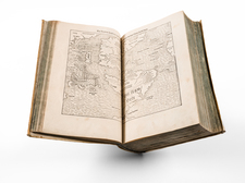
An excellent example of Munster's Cosmographia, one of the most successful and influential descriptions of the world published during the Renaissance, here in the 1578 edition (first issued in 1544). Munster's Cosmographia was published alongside his Geographia (first issued in 1540) and grew to include numerous city views and other maps over its publication run. This edition of the Cosmographia includes numerous double-page woodcut views of cities, as well as some folding city views. This represents a major augmentation of the compliment of double-page maps that occurred in the early editions of Cosmographia and Munster's Geographia.
The work includes a suite of modern maps as well as traditional Ptolemaic cartography. The book includes a modern and Ptolemaic world map, both highly prized as individual maps, and the first modern map of Asia.
According to Burden (12), Munster's Cosmographia more than his Geographia was the book that sealed the fate of "America" as the name of the New World.
Munster's Map of the Americas
Munster's map of America is the earliest map to show all of North and South America in a true continental form. The first edition of the map appeared in Munster's Geographia, first published in 1540. However, it was the map's inclusion in the 1544 edition of Munster's Cosmographia that forever caused America to be the name of the New World, perpetuating Waldseemuller's choice of names in a popular and widely disseminated work.
Munster's map is the earliest map to show all of the continents of America and the first to name the Pacific Ocean (Mare Pacificum). The depiction of North America is dominated by one of the most dramatic geographic misconceptions to be found on early maps-the so-called Sea of Verrazzano. The Pacific cuts deeply into North America so that the part of the coastline at this point is a narrow isthmus between two oceans. This was the result of Verrazzano mistaking the waters to the west of the Outer Banks, the long barrier islands along North Carolina as the Pacific. The division of the New World between Spain and Portugal Spain and Portugal is recognized on the map by the Castille and Leon flag planted in Puerto Rico, here called Sciana.
The map includes a host of firsts, too many to include in this description. Includes a very early appearance of the Straits of Magellan, along with his ship Victoria in the Pacific. The earliest appearance of Japan on a map, predating European contact and based solely legends, such as Marco Polo. The Yucatan Peninsula is shown as an Island. Lake Temistan empties into the Caribbean. The map depicts cannibals in South America and names Florida. The misinformation provided by Verazanno is perpetuated. The map depicts cannibals in South America and names Florida.
Conclusion
Overall an incredible work of craftsmanship and science, a representation of the Renaissance worldview and known world in the 16th century.
Collation:
Complete: a6, a6, 26 double-page woodcut maps, A-E8, F6, G2, H4, I-O2, P4, Q8, R4, S2, T-X8, Y4, Z2, Aa2, Bb8, Cc4, Dd6, Ee4, Ff-Ii2, Kk6, Ll-Mm8, Nn-Oo2, Pp-Yy8, Zz4, AA4, BB-CC8, DD6, EE2, FF-GG4, HH6, II8, KK6, LL-MM8, NN4, OO-PP2, QQ4, RR2, SS4, TT-ZZ2, AAa8, BBb4, CCc2, DDd-EEe8, FFf4, GGg6, HHh-KKk4, LLl-MMm8, NNn6, OOo8, PPp-RRr4, SSs2, TTt8, UUu6, XXx2, YYy6, ZZz4, Aaa6, Bbb2, Ccc-Ddd8, Eee4, Fff2, Ggg6, Hh2, Iii4, Kkk-Nnn8, Ooo-Ppp6, Qqq4, Rrr2, Sss8, Ttt6, Uuu4, Xxx-Zzz8, AAA-CCC8, DDD4, EEE2, FFF-GGG8, HHH6, III4, KKK-NNN8, OOO2, PPP8, QQQ6, RRR4, SSS6.
Sebastian Münster (1488-1552) was a cosmographer and professor of Hebrew who taught at Tübingen, Heidelberg, and Basel. He settled in the latter in 1529 and died there, of plague, in 1552. Münster made himself the center of a large network of scholars from whom he obtained geographic descriptions, maps, and directions.
As a young man, Münster joined the Franciscan order, in which he became a priest. He then studied geography at Tübingen, graduating in 1518. He moved to Basel, where he published a Hebrew grammar, one of the first books in Hebrew published in Germany. In 1521 Münster moved again, to Heidelberg, where he continued to publish Hebrew texts and the first German-produced books in Aramaic. After converting to Protestantism in 1529, he took over the chair of Hebrew at Basel, where he published his main Hebrew work, a two-volume Old Testament with a Latin translation.
Münster published his first known map, a map of Germany, in 1525. Three years later, he released a treatise on sundials. In 1540, he published Geographia universalis vetus et nova, an updated edition of Ptolemy’s Geographia. In addition to the Ptolemaic maps, Münster added 21 modern maps. One of Münster’s innovations was to include one map for each continent, a concept that would influence Ortelius and other early atlas makers. The Geographia was reprinted in 1542, 1545, and 1552.
He is best known for his Cosmographia universalis, first published in 1544 and released in at least 35 editions by 1628. It was the first German-language description of the world and contained 471 woodcuts and 26 maps over six volumes. Many of the maps were taken from the Geographia and modified over time. The Cosmographia was widely used in the sixteenth and seventeenth centuries. The text, woodcuts, and maps all influenced geographical thought for generations.