This item has been sold, but you can enter your email address to be notified if another example becomes available.


|
||

|

|
|

|
Stock# 68290
Description
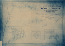
The Lindgren Brothers Rarity
"Hatched and Scratched by Jolly Lindgren," this comic pictorial map is full of puns and comic vignettes related to the region centered on Boulder Dam and Las Vegas.
The map shows the Grand Canyon, Death Valley, Cedar Breaks, Bryce Canyon, Zion and Kaibab National Forest.
The Lindgren Brothers issued a number of other silly whimsical maps of national parks and other parts of the West, beginning in 1933.
In addition to this map, the Lindgren Brothers issued maps for the Grand Canyon in 1936 and 1940:
- A hysterical map of Grand Canyon National Park; a mile deep and ever so wide; where Mother Nature started from scratch.
- A hysterical map of Grand Canyon National Park; a mile deep and ever so wide; a swell place to throw your old razor blades.
Rarity
The present map is among the rarest of all maps by the Lindgren Brothers.
This is the second example of the map we have ever seen. OCLC locates at copy at UCLA.
Condition Description
Minor loss at lower left corner, just touching printed image. Tear at left center, entering printed image and minor chip, just touching printed image.
![[Monterey] Plan De La Baie De Monterey Situee Dans La Californie Septentrionale . . .](https://storage.googleapis.com/raremaps/img/small/99008.jpg)
![[Pictorial Map of the United Arab Republic] Kharitat Musawwarat al-Jumhuriya al-'Arabiya al-Muttahida / خريطة مصورة الجمهورية العربية المتحدة](https://storage.googleapis.com/raremaps/img/small/55146.jpg)