
1598 Edition of Ptolemy's Geography
An excellent example of Rosaccio's improvement on Ruscelli's Ptolemy, adding contemporaneous knowledge and interpretations and extensively reworking the copperplate-engraved maps with decorative sea monsters and ships. Five new maps have been added since the previous edition, which had been published in 1574 ((Europe, Hungaria et Transilvania, Africa, Asia and America). Many maps have been updated, for example, the double hemisphere world map now has a large southern Terra Australis, occupying a vast portion of the globe.
This is the sixth edition of Ruscelli's Ptolemy, and the fourth to be published in Italian. The volume contains two parts, the first of which is in eight books and the latter of which in four.
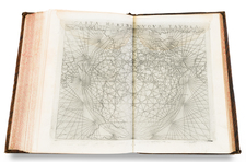
This work was written as the sun set on Ptolomy's millennia-long domination on the studies of geography. Recognizing this, the work compares Ptolomy's geography to "modern" geography. The first section provides a full account of Ptolomeic geography, detailing coordinates for hundreds of localities, including cities, mountains, and supposed historical features. This section includes twenty-seven maps, and any superfluous descriptions and discussions of Ptolomeic geography are limited to the twenty pages of bridge text between the two sections. The second part, comprising four books, touches on more modern concepts of geography. This section includes thirty-seven maps and includes detailed descriptions of the regions of the world. These two sections are ordered similarly, allowing for easy comparison between the two schools of thought. As such, this work provides a fascinating look at how concepts regarding world geography were changing during the 16th century.
Provenance
Title page with the signature of Andrea Buonuciavi (sp?), written in a 19th-century? hand. Early ink manuscript in Italian on the final blank.
Girolamo Ruscelli (1500-1566) was a cartographer, humanist, and scholar from Tuscany. Ruscelli was a prominent writer and editor in his time, writing about a wide variety of topics including the works of Giovanni Boccaccio and Francesco Petrarch, Italian language, Italian poetry, medicine, alchemy, and militia. One of his most notable works was a translation of Ptolemy’s Geographia which was published posthumously.
There is limited information available about Ruscelli’s life. He was born in the Tuscan city of Viterbo to a family of modest means. He was educated at the University of Padua and moved between Rome and Naples until 1548, when he moved to Naples to work in a publishing house as a writer and proofreader. He remained in the city until his death in 1566.
Claudius Ptolemy (fl. AD 127-145) was an ancient geographer, astronomer, and mathematician. He is known today through translations and transcriptions of his work, but little is known about his life besides his residence in Alexandria.
Several of his works are still known today, although they have passed through several alterations and languages over the centuries. The Almagest, in thirteen books, discusses astronomy. It is in the Almagest that Ptolemy postulates his geocentric universe. His geometric ideas are contained in the Analemma, and his optical ideas were presented in five books known as the Optica.
His geographic and cartographic work was immensely influential. In the Planisphaerium, Ptolemy discusses the stereographic projection. Perhaps his best-known work is his Geographia, in eight books. However, Ptolemy’s ideas had been absent from western European intellectual history for roughly a thousand years, although Arab scholars interacted with his ideas from the ninth century onward.
In 1295, a Greek monk found a copy of Geographia in Constantinople; the emperor ordered a copy made and the Greek text began to circulate in eastern Europe. In 1393, a Byzantine diplomat brought a copy of the Geographia to Italy, where it was translated into Latin in 1406 and called the Cosmographia. The manuscript maps were first recorded in 1415. These manuscripts, of which there are over eighty extant today, are the descendants of Ptolemy’s work and a now-lost atlas consisting of a world map and 26 regional maps.
When Ptolemy’s work was re-introduced to Western scholarship, it proved radically influential for the understanding and appearance of maps. Ptolemy employs the concept of a graticule, uses latitude and longitude, and orients his maps to the north—concepts we take for granted today. The Geographia’s text is concerned with three main issues with regard to geography: the size and shape of the earth; map projection, i.e. how to represent the world’s curve proportionally on a plane surface; and the corruption of spatial data as it transfers from source to source. The text also contains instructions as to how to map the world on a globe or a plane surface, complete with the only set of geographic coordinates (8000 toponyms, 6400 with coordinates) to survive from the classical world.