|
||

|

|
|

|
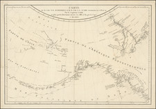
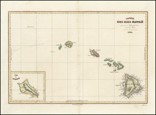
Early detailed map of the Southern part of the Pacific, extending from Southeast Asia, Australia and New Zealand to Hawai'i and the West Coast of the United States and Mexico, centered on New Zealandand the Carolines. One of the earliest general maps of Oceana to appear in a commercial atlas.
Andre Hubert Brué was a French geographer and cartographer. Born in Paris, he served in the French Navy, joining the Baudin expedition to the Pacific (1800-1804). After his sea service, Brué applied his navigation and charting skills to creating finely-crafted maps, which were renowned for their crisp engraving and accuracy. He drew directly on the copper of the plate, creating what he called encyprotypes. He is best known for the Atlas universal de géographie physique, politique, ancienne et moderne.