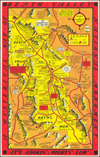


|
||

|

|
|

|
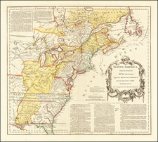
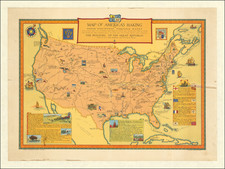
A great pictorial map of America produced for the nation's sesquicentennial and targeted at school-age children. The map shows the continental United States in an antique manner and includes many fascinating pictorial images, designed in a manner resembling a free-hand sketch. The vast troves of information on the map are as fascinating to a modern student as they were in 1922.
The map details the path of early explorers to the area including Verrazano, John Smith, Drake, Cabrillo, and many others. In the oceans, the vessels these explorers used can be found, including The Golden Hinde, The Pilgrim Ship, and The Savannah. Pictorial detail inland shows many points of interest in Americana tellings of history, including Lincoln's log cabin, the Wells Fargo Express, and the Old North Church. Three boxes of text describe early colonial claims in the New World, the early republican period, and the frontier.
The map is a great example of a work from the early period of pictorial cartography and possesses an attractive vintage feel.