


|
||

|

|
|

|
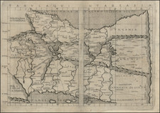
One of two "Earliest maps known to me that indicate a greater readiness to modernize the content of maps of Iran"--Sonja Brentjes, Scientific Historian at the Max Planck Institute. Very Rare.
This is a very rare attractive map of the northeastern Persian Empire, stretching from the Caspian Sea to western Afghanistan. The map is extensively detailed, with topography shown in shaded relief, and hundreds, if not thousands, of settlements, cities, roads, rivers, lakes tribes, and political divisions shown. Extensive German-language information add to the interest of the map. Five major regions are demarcated and labeled: Persia, Afghanistan, "Sedsches," "Bochara," and "Krakum."
This map was drafted by the military surveyor Carl Zimmerman and intended to accompany the third volume of Ritter's nineteen part (twenty-one volume) work Erdkunde im Verhaltnis zur Natur und zur Geschichte des Mensche oder allgmeine, vergleichende Geographie, als sichere Grundlage des Studiums und Unterricts in physicalischen und historischen Wissenschaften. Zimmerman produced two such map showing a region of Iran, a map of Fars, and the present map of Khorasan.
The name Khorasan dates to the Sasanian Empire, when it was used to refer to the eastern province of Persia. In the late nineteenth century, it demarcated an Iranian province, which was separated into three divisions in 2004.
Sonja Brentjes says of this map that:
"The earliest maps known to me that indicate a greater readiness to modernize the content of Iran were drafted by the military surveyor Carl Zimmermann for Ritter's work on geography . . . Their novel elements are data on elevations of mountain ranges, peaks, and mountainous villages, geological information on iron, mineral salts, marble, or limestone, indication of agricultural products, and demarcation of uncertainties in knowledge."
Carl Ritter's Great Work
Carl Ritter is considered one of the founders of modern geography and was an important figure of his time. Ritter's Erdkunde im Verhaltnis. . . attempted to describe the geography of the entire globe. This work had a very broad concept of geography, not only encompassing cartography but also hydrography, climatology, and volcanology. Ritter never completed his work due to the vast scale of his undertaking.
Ritter's depiction of Persia was advanced for its time, representative of the state of German knowledge of the region. German cartography of Persia was ahead of other European nations at the time, due to the scientific approaches and vast amounts of sources used. German cartographers were known to be particularly exasperated by the imprecise notes left by non-German archeologists.
Rarity and additional information
This map appears in Zentralbibliothek Zurich's catalog, though we have not been able to locate other copies of this map or any that have been on the market.
This work was printed during 1840/41 and later in 1843.
Two stamps from the archives of the French Ministeres des Affaires Etrangeres appear on the map, circa 1930s.
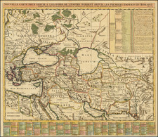
![[Empire of Alexander The Great] Antiquor? Imperiorum Tabula in qua prae caeteris, Macendonia seu Alexandri Magni et Expeditiones exarantur . . .](https://storage.googleapis.com/raremaps/img/small/70608.jpg)
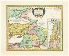
![[Map of the Persian Gulf]](https://storage.googleapis.com/raremaps/img/small/99842.jpg)