|
||

|

|
|

|
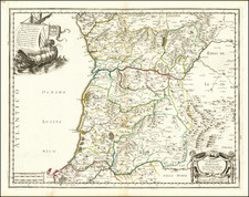
Merian's map of Portugal is an intriguing piece of historical cartography based on an earlier map by Willem Blaeu, a renowned Dutch cartographer and publisher of the 17th century. This particular map demonstrates several key aspects of map-making from that era, reflecting both technical advancements and the cultural milieu of the time.
The west-oriented design of the map is an immediate point of interest. In contrast to the conventional north-up orientation, this choice might have been influenced by the dominant role the Atlantic Ocean played in Portugal's socio-economic landscape during the Age of Discovery. The nation was then a pioneering maritime power, embarking on expeditions that discovered and mapped much of the world's unknown territories. This unusual orientation, therefore, might have served to emphasize the importance of the sea to Portugal's exploratory endeavours.
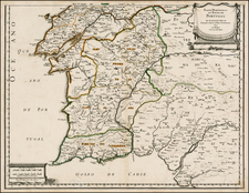
The presence of two coats of arms represents the heraldry of Portugal. These elements serve as symbols of political power and territorial claim, further asserting Portugal's sovereignty and pride. The inclusion of three sailing ships on the sea is a notable feature, reflecting the period's maritime activities. Portugal, as a pioneering force in global exploration, had a formidable naval presence. These ships symbolize the country's commitment to maritime exploration and its formidable role in global seafaring activities.
The allegorical image of a sea god riding a whale is a cultural imprint, echoing the period's myths and beliefs. This addition underlines the pervasive belief in the dominion of mythical entities over natural elements, such as the sea, particularly relevant for a maritime nation like Portugal.
Mathaus Merian (1593-1650) was the father of engraver Matthäus the Younger, and of the painter, engraver, and naturalist Maria Sibylla Merian. He was born in Basel, Switzerland and trained in engraving in Zurich. After a time in Nancy, Paris and Strasbourg, he settled in Frankfurt. While there, he worked for Johann Theodor de Bry, the publisher and son of the travel writer. In 1617, he married Maria Magdalena de Bry, Johann Theodor’s daughter. In 1623, Merian took over the de Bry publishing house upon the death of his father-in-law. Merian’s best known works are detailed town views which, due to their accuracy and artistry, form a valuable record of European urban life in the first half of the sixteenth century

![[Portugal / Morocco / Azores & Canary Islands] Pascaarte Van Barbarische cust mitsgaders van de Canarische en Vlaemsche Eijlanden](https://storage.googleapis.com/raremaps/img/small/75279.jpg)