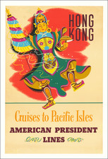
|
||

|

|
|

|
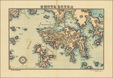
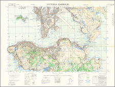
For Official Use Only. A Large Map of Hong Kong During the 1911 Revolution.
Large antique map of Hong Kong Island and the region north to the Sham Chun River.
The map was prepared by the Royal School of Military Engineering in concert with the Geographical Section, War Office for this strategically vital part of the British Empire. The map was produced in the context of the Revolution of 1911, which overthrew the Qing Dynasty. In light of the massive political changes in China, especially southern China, during the Revolution, it was unclear if Hong Kong and Macao would remain under foreign control. The famous 99-year lease of British Hong Kong and the "New Leased Territory" had just begun in 1898, and this map was Britain's best accounting of their new possession.
The topography of the area is rendered with contours and the heights of many peaks are listed. Dozens of villages and communities are illustrated and labeled throughout the map.
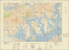
New Leased Territory.
Britain secured the New Leased Territories in 1898 as an extension of Kowloon. The primary motive in expanding the holdings was to counter the encroachment of the other European powers, including France in southern China, and the Russians at Port Arthur.
The map shows rivers, mountains, and villages in the New Territories. The main roads and railway are also shown. The village of Sham Chun is shown just over the Frontier.
Rarity
The map was prepared for official use by British government officials and therefore is quite rare. OCLC locates only examples at the Australian National University Library and the British Library.
We are aware of at least two possible variants of the map. The first with the "(FOR OFFICIAL USE ONLY)" stamped in the upper-right corner with a separate ink stamp (as here), the second with that warning printed.