|
||

|

|
|

|
"One of the great pictures of the century" - Time Magazine
A picture looking obliquely across Copernicus Crater, which appeared in Time Magazine after NASA Scientist Martin Swetnick called it "one of the great pictures of the century.” In it, we see nearly sixty miles across a deep crater, with hundreds more miles of lunar surface in the foreground and background. Except for the jet black sky, one could nearly picture a similar scene on earth.
Surprisingly, this image was only taken as a means to advance the film between the surveying of possible landing sites. The footage was never intended to be used, but the perfect image that happened to be captured so impressed scientists and the public that it became an immediate hit.
The Copernicus Crater was formed as a result of a relatively young meteorite impact, with guesses for the age of formation of around 800 million years before present. Lunar Orbiter 5 surveyed the crater in greater detail, and Terry Offield of the USGS described the formation as having "a hummocky crater rim, numerous large slump blocks on the crater wall, and a complex of central peaks. Sets of parallel fractures, aligned with the lunar structure grid, formed after the crater wall took its present form, but before the smoothest floor materials were emplaced. The smooth floor materials show a swirling pattern of cracks like those seen on terrestrial lava flows. These materials are associated with numerous hills that have summit craters and are probably small volcanoes. Several low places on the rim and wall are partly filled by what appears to be ponded volcanic material, or possibly fluidized impact debris."
Provenance
From the collection of a veteran of Boeing's Public Relations and Advertising Department who joined the company in 1961.
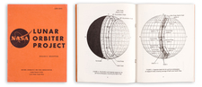
The Lunar Orbiters were a series of five unmanned spacecraft which undertook detailed mapping of the moon in 1966-1967. By taking thousands of photos over five missions, the surface of the moon was able to be mapped down to a meter scale. This would allow for both increased scientific understanding of the moon, as well as helping to identify possible landing sites for the Surveyor and Apollo missions.
The orbiters were the result of a joint bid between Boeing and Eastman Kodak. The Air Force was originally planned to take charge of the imaging operation, but concerns over the classified nature of their camera specifications led to lower-resolution, privately-designed, cameras being used. These ended up working well in part due to an ingenious focusing mechanism, and ninety-nine percent of the surface of the moon, including the dark side of the moon, was successfully mapped.
The orbiters not only provided visual information but also gravitational information. Doppler tracking of the orbiters allowed for gravity anomalies over maria to be measured, allowing for a better understanding of the moon's gravitational field. These measurements showed that both Airy and Pratt isostasy were important on the moon, meaning that topography was both due to compositional and mass differences.
The first three missions focused on surveying the sites for the Apollo landing missions, while the last two focused more on completing the lunar mapping mission. Lunar Orbiter 2 would be the first to photograph the Sea of Tranquility, the landing site for Apollo 11. Each orbiter crashed on the moon several months after its mission ended.
![[Moon rock or boulder from the Apollo 16 mission, numbered AS16-108-17694.]](https://storage.googleapis.com/raremaps/img/small/93459.jpg)